|
search place name
|
||
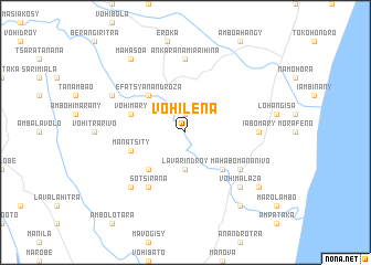
Vohilena (Fianarantsoa, Madagascar)Vohilena is a town in the Fianarantsoa region of Madagascar. An overview map of the region around Vohilena is displayed below.
regional and 3d topo map of Vohilena, Madagascar ::
Vohilena airports ::
The nearest airport is RVA - Farafangana, located 42.7 km north east of Vohilena.
Other airports nearby include WVK - Manakara (120.9 km north), WFI - Fianarantsoa (196.7 km north), FTU - Tolagnaro (220.2 km south), MNJ - Mananjary (228.3 km north), Nearby towns ::
Amboahangibe (1.9km north) //
Lavarindroy (3.7km south) //
Efatsy-Anandroza (5.0km north west) //
Iabomora (5.0km south west) //
Lopary (5.0km south east) //
Vohimary (5.4km west) //
Mahariteno (5.4km west) //
Manatsity (5.4km west) //
Anarabe (6.5km south west) //
Sotsirana (6.5km south west) //
Mahabo-Mananivo (6.3km south east) //
Ankarana-Miraihina (7.4km north) //
Iabomary (6.8km east) //
Betsiraha (7.6km south west) //
Vohimalaza (7.6km south east) //
Fenoarivo (7.8km north west) //
Mahasoa (9.0km north west) //
Mahatsinjo (9.0km south east) //
Mahafasa (9.0km south east) //
Nosiala (8.8km south east) //
[all distances 'as the bird flies' and approximate] 
Disclaimer :: Information on this page comes without warranty of any kind |
||
|
Where is Vohilena? Elevation and coordinates ::
Latitude (lat): 23°9'0"S Longitude (lon): 47°38'0"E
Elevation (approx.): 6m (map arrows pan, magnifying glasses zoom) |
||
|
Visiting Vohilena? Hotel/Accommodation ::
Book a hotel in Vohilena Travel Guide ::
Buy a travel guide for Madagascar rental cars ::
car rental offers GPS waypoint ::
download a GPX waypoint (PoI) of Vohilena for your GPS receiver
|
||