|
search place name
|
||
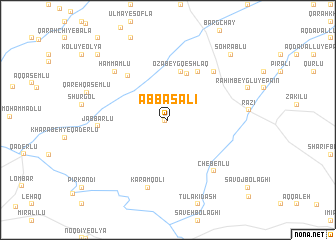
‘Abbās‘alī (Ardabīl, Iran)‘Abbās‘alī is a town in the Ardabīl region of Iran. An overview map of the region around ‘Abbās‘alī is displayed below.
regional and 3d topo map of ‘Abbās‘alī, Iran ::
‘Abbās‘alī airports ::
The nearest airport is TBZ - Tabriz Intl, located 165.0 km west of ‘Abbās‘alī.
Other airports nearby include RAS - Rasht (200.0 km south east), Nearby towns ::
Ḩasanlū (0.3km south west) //
Gorūh Dīk Dāghī (5.4km north) //
Ḩoseyn Khān Kandī (5.5km north) //
Ozābeyg Qeshlāq (5.5km north) //
Balūţ Kandī (6.0km north east) //
Naşīr Kandī (6.0km north west) //
Haft Cheshmeh (6.8km north east) //
Chebenlū (7.0km south east) //
Jabbārlū (6.1km west) //
Karam Qolī (7.8km south) //
Ḩammāmlū (7.1km north west) //
Raḩīm Beyglū-ye Pā'īn (7.8km north east) //
Sohrāblū (9.1km north east) //
Darreh Beyglū (9.5km north west) //
Sāvoj Bolāghī (10.3km south east) //
[all distances 'as the bird flies' and approximate]  Places with similar names to ‘Abbās‘alī, Iran ::
// Abū Şāliḩ (IQ)
// Abazlı (TR)
// Absal (TR)
// Āb Seylā'ī (IR)
// Āb Zālū (IR)
// Āb Zālū (IR)
// Āb Zālū (IR)
// Āb Zehlū (IR)
// Abou Assal (TD)
// Abasolo (MX)
Disclaimer :: Information on this page comes without warranty of any kind |
||
|
Where is ‘Abbās‘alī? Elevation and coordinates ::
Latitude (lat): 38°37'5"N Longitude (lon): 48°1'12"E
Elevation (approx.): 1301m (map arrows pan, magnifying glasses zoom) |
||
|
Visiting ‘Abbās‘alī? Hotel/Accommodation ::
Book a hotel in ‘Abbās‘alī Travel Guide ::
Buy a travel guide for Iran rental cars ::
car rental offers GPS waypoint ::
download a GPX waypoint (PoI) of ‘Abbās‘alī for your GPS receiver
|
||