|
search place name
|
||
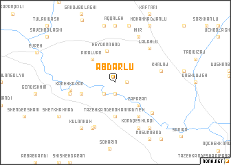
Ābdārlū (Iran)Ābdārlū is a town in Iran. An overview map of the region around Ābdārlū is displayed below.
regional and 3d topo map of Ābdārlū, Iran ::
Ābdārlū airports ::
The nearest airport is TBZ - Tabriz Intl, located 171.2 km west of Ābdārlū.
Other airports nearby include RAS - Rasht (178.8 km south east), Nearby towns ::
Jamāyrān (1.5km east) //
Mejandī (1.9km south) //
‘Alī Qeshlāqī (2.4km south west) //
Yengejeh-ye Mollā Moḩammad Ḩasan (2.4km south west) //
Pīr Ālvān (4.7km north west) //
Za‘farān (4.7km south east) //
Ḩeydarābād (5.2km north) //
Tāzeh Kand-e Moḩammadīyeh (5.6km south) //
Rū'īn Z̄arī (4.7km south west) //
Naqdī Kandī (6.3km south east) //
Kaneh Karān (5.9km west) //
Khalaj (6.1km east) //
Qūnāq Qerān (6.1km west) //
Ţāleb Qeshlāqī (6.9km south east) //
Lalahlū (7.1km north east) //
Abr Bakūh (7.7km south) //
Īmīr (8.0km north) //
Īrebkū (8.0km south) //
Kord Qeshlāqī (8.0km south) //
Kūlān Kūh (8.6km south west) //
Ḩayehdār (8.6km south east) //
[all distances 'as the bird flies' and approximate] 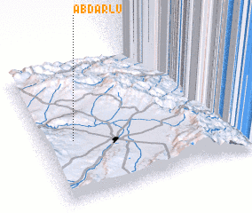 Places with similar names to Ābdārlū, Iran :: Disclaimer :: Information on this page comes without warranty of any kind |
||
|
Where is Ābdārlū? Elevation and coordinates ::
Latitude (lat): 38°27'0"N Longitude (lon): 48°9'0"E
Elevation (approx.): 1390m (map arrows pan, magnifying glasses zoom) |
||
|
Visiting Ābdārlū? Hotel/Accommodation ::
Book a hotel in Ābdārlū Travel Guide ::
Buy a travel guide for Iran rental cars ::
car rental offers GPS waypoint ::
download a GPX waypoint (PoI) of Ābdārlū for your GPS receiver
|
||