|
search place name
|
||
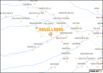
‘Abdollābād (Khorāsān, Iran)‘Abdollābād is a town in the Khorāsān region of Iran. An overview map of the region around ‘Abdollābād is displayed below.
regional and 3d topo map of ‘Abdollābād, Iran ::
‘Abdollābād airports ::
The nearest airport is ASB - Ashkhabad Ashgabat, located 81.0 km north west of ‘Abdollābād.
Nearby towns ::
Kalāteh-ye Zāl Khān (0.0km north) //
Sa‘dābād (1.4km north west) //
Sangbor (1.5km east) //
Ūtānlū (2.1km south west) //
Maḩmūdābād (2.4km north east) //
Qareh Qowyūnlū (2.9km west) //
Faẕlābād (3.7km north) //
Qal‘echeh (3.5km south east) //
Khākhīān (4.7km north east) //
Kāhū (4.4km north west) //
Āq Cheshmeh (4.4km east) //
Tāj ed Dīn (5.3km south west) //
Bahmanābād (5.8km north west) //
Sādāt (5.8km south east) //
Kalāteh-ye Shūr (6.3km north east) //
Qal‘eh-ye ‘Abbāsī (7.1km south east) //
Parkand (7.1km south east) //
Now Khandān (8.1km north) //
Dūdānlū (7.3km south west) //
Ḩaẕrat Solţān (8.5km north west) //
Ramazān Qal‘eh (8.6km north east) //
Ḩaqverdī (8.6km south east) //
Jashnābād (8.1km north west) //
Chāpeshlū (10.7km south east) //
[all distances 'as the bird flies' and approximate] 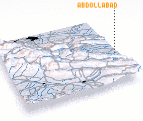 Places with similar names to ‘Abdollābād, Iran ::
// Abdālābād (IR)
// ‘Abdolābād (IR)
// ‘Abdolābād (IR)
// ‘Abdolābād (IR)
// ‘Abdolābād (IR)
// ‘Abdolābād (IR)
// ‘Abdolābād (IR)
// ‘Abdolābād (IR)
// ‘Abdolābād (IR)
// ‘Abdolābād (IR)
Disclaimer :: Information on this page comes without warranty of any kind |
||
|
Where is ‘Abdollābād? Elevation and coordinates ::
Latitude (lat): 37°27'0"N Longitude (lon): 58°59'0"E
Elevation (approx.): 660m (map arrows pan, magnifying glasses zoom) |
||
|
Visiting ‘Abdollābād? Hotel/Accommodation ::
Book a hotel in ‘Abdollābād Travel Guide ::
Buy a travel guide for Iran rental cars ::
car rental offers GPS waypoint ::
download a GPX waypoint (PoI) of ‘Abdollābād for your GPS receiver
|
||