|
search place name
|
||
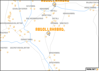
‘Abdollāhābād (Kermān, Iran)‘Abdollāhābād is a town in the Kermān region of Iran. An overview map of the region around ‘Abdollāhābād is displayed below.
regional and 3d topo map of ‘Abdollāhābād, Iran ::
‘Abdollāhābād airports ::
The nearest airport is BND - Bandar Abbass Intl, located 187.1 km south west of ‘Abdollāhābād.
Other airports nearby include KER - Kerman (237.4 km north), Nearby towns ::
Farrokhābād (1.3km west) //
Amīrābād (3.0km north east) //
Mīrābād (4.0km north east) //
‘Abbāsābād (3.9km south west) //
Jamālābād (4.9km north east) //
Khātūnābād (5.3km north) //
Jangalābād-e Pā'īn (5.2km west) //
Sang-e Sefīd (5.2km east) //
Naz̧mābād (5.8km north) //
Pātalī (5.9km north) //
Sabz Gezī (6.1km north east) //
Qanāt Now (6.9km north) //
Qāsemābād (7.6km south) //
Salmānābād-e Pā'īn (7.4km north west) //
Ḩoseynābād-e Sheybānī (7.1km west) //
Bahādorābād-e Bālā (8.3km south) //
Moḩammadābād-e Kalāntar (7.4km west) //
Maḩmūdābād (8.4km north) //
Kheyrābād (8.5km north) //
Pātelī (8.6km north) //
Raḩmatābād (8.0km west) //
Maḩmūdābād (9.9km north east) //
[all distances 'as the bird flies' and approximate] 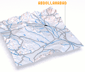 Places with similar names to ‘Abdollāhābād, Iran ::
// Abdullāhābād (PK)
// ‘Abdollāhābād (IR)
// ‘Abdollāhābād (IR)
// ‘Abdollāhābād (IR)
// ‘Abdollāhābād (IR)
// ‘Abdollāhābād (IR)
// ‘Abdollāhābād (IR)
// ‘Abdollāhābād (IR)
// ‘Abdollāhābād (IR)
// ‘Abdollāhābād (IR)
Disclaimer :: Information on this page comes without warranty of any kind |
||
|
Where is ‘Abdollāhābād? Elevation and coordinates ::
Latitude (lat): 28°17'0"N Longitude (lon): 57°51'0"E
Elevation (approx.): 571m (map arrows pan, magnifying glasses zoom) |
||
|
Visiting ‘Abdollāhābād? Hotel/Accommodation ::
Book a hotel in ‘Abdollāhābād Travel Guide ::
Buy a travel guide for Iran rental cars ::
car rental offers GPS waypoint ::
download a GPX waypoint (PoI) of ‘Abdollāhābād for your GPS receiver
|
||