|
search place name
|
||
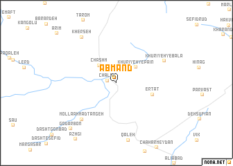
Āb Mand (Iran)Āb Mand is a town in Iran. An overview map of the region around Āb Mand is displayed below.
regional and 3d topo map of Āb Mand, Iran ::
Āb Mand airports ::
The nearest airport is THR - Teheran Mehrabad Intl, located 179.2 km west of Āb Mand.
Nearby towns ::
Chālār (1.3km west) //
Chāshm (3.6km north west) //
Khūrīyeh-ye Pā'īn (3.6km north east) //
Ertat (5.1km east) //
Mollā Aḩmad Tangeh (7.4km south west) //
Khūrīyeh-ye Bālā (7.2km north east) //
Kherseh (8.7km north west) //
Godār Bon (9.5km south west) //
[all distances 'as the bird flies' and approximate]  Places with similar names to Āb Mand, Iran ::
// Abu Mendi (ET)
// Abbey Mount (IE)
Disclaimer :: Information on this page comes without warranty of any kind |
||
|
Where is Āb Mand? Elevation and coordinates ::
Latitude (lat): 35°52'0"N Longitude (lon): 53°17'0"E
Elevation (approx.): 2077m (map arrows pan, magnifying glasses zoom) |
||
|
Visiting Āb Mand? Hotel/Accommodation ::
Book a hotel in Āb Mand Travel Guide ::
Buy a travel guide for Iran rental cars ::
car rental offers GPS waypoint ::
download a GPX waypoint (PoI) of Āb Mand for your GPS receiver
|
||