|
search place name
|
||
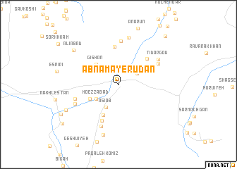
Ābnamā-ye Rūdān (Hormozgān, Iran)Ābnamā-ye Rūdān is a town in the Hormozgān region of Iran. An overview map of the region around Ābnamā-ye Rūdān is displayed below.
regional and 3d topo map of Ābnamā-ye Rūdān, Iran ::
Ābnamā-ye Rūdān airports ::
The nearest airport is BND - Bandar Abbass Intl, located 91.5 km west of Ābnamā-ye Rūdān.
Other airports nearby include KHS - Khasab (175.9 km south west), RKT - Ras Al Khaimah Intl (244.1 km south west), Nearby towns ::
Kahnūj-e Bālā (3.1km north east) //
Āsīāb (4.0km south west) //
Mo‘ezzābād (3.8km south west) //
Gīshān (4.5km north west) //
Golestān (4.6km south west) //
Sarjū'īyeh (5.3km south west) //
Sey Galm (5.7km north east) //
Zīlūn (6.0km north) //
Sarjū'īyeh-ye Pā'īn (6.2km south) //
Espīrī (6.9km north) //
Deh Mātom (6.5km north east) //
Kalbar (6.5km west) //
Kharājī (7.1km south) //
Bālā Shahr (6.8km south west) //
Bālā Shahr-e Deh Bārez (6.8km south west) //
Tīdargow (6.9km north east) //
Naftī (7.5km north) //
Gheybī (8.3km south) //
‘Alīābād (8.2km north west) //
‘Īsáābād (8.5km south west) //
Anārūn (9.3km north) //
Ḩanārū (10.1km north east) //
Sangī (10.0km south west) //
[all distances 'as the bird flies' and approximate]  Places with similar names to Ābnamā-ye Rūdān, Iran :: Disclaimer :: Information on this page comes without warranty of any kind |
||
|
Where is Ābnamā-ye Rūdān? Elevation and coordinates ::
Latitude (lat): 27°28'11"N Longitude (lon): 57°15'31"E
Elevation (approx.): 224m (map arrows pan, magnifying glasses zoom) |
||
|
Visiting Ābnamā-ye Rūdān? Hotel/Accommodation ::
Book a hotel in Ābnamā-ye Rūdān Travel Guide ::
Buy a travel guide for Iran rental cars ::
car rental offers GPS waypoint ::
download a GPX waypoint (PoI) of Ābnamā-ye Rūdān for your GPS receiver
|
||