|
search place name
|
||
‘Alamdārī (Khūzestān, Iran)‘Alamdārī is a town in the Khūzestān region of Iran. An overview map of the region around ‘Alamdārī is displayed below.
regional and 3d topo map of ‘Alamdārī, Iran ::

‘Alamdārī airports ::
The nearest airport is QMJ - Masjed Soleiman Shahid Asyaee, located 23.1 km south east of ‘Alamdārī.
Other airports nearby include AWZ - Ahwaz (100.7 km south), MRX - Bandar Mahshahr Mahshahr (180.4 km south), ABD - Abadan (219.3 km south west), BSR - Basrah Intl (229.9 km south west), Nearby towns ::
Sar Cheshmeh (0.0km north) //
Tāj ed Dīn (0.0km north) //
Par-e Shūshtarī (1.9km south) //
Qal‘eh-ye Shīās (2.1km north west) //
Ja‘far (2.4km south east) //
Jājū ‘Olyā (2.4km south east) //
Jājū Soflá (2.4km south east) //
Cheshmeh Shīrīn (2.4km south west) //
Gazestān (2.4km north east) //
Sarpar (3.1km west) //
Talkhāb-e Tāj ed Dīn (3.1km west) //
Konār-e Hashtlīk (3.8km north west) //
Golestān (3.6km north east) //
Chāl Tāk (4.0km north east) //
Gārā (4.0km north east) //
Par Neveshteh-ye Do (4.2km west) //
Sālār-e Shahīdān (4.9km south east) //
Dezeh Kān (5.1km north west) //
Par Neveshteh-ye Yek (4.7km west) //
Selīrān-e Soflá (5.0km south east) //
Zākā (5.8km north) //
Deh Gah (5.1km west) //
Shamsābād (6.3km south west) //
Boneh-ye Farz ‘Alī (6.4km south west) //
Cheshmeh-ye Mollā Raḩmat (6.0km south east) //
Āb Zālū-ye ‘Arab (6.0km north west) //
Āb Zālū-ye Bahrām (6.0km north west) //
Alīābād (6.4km south west) //
Selīrān-e ‘Olyā (6.3km south east) //
[all distances 'as the bird flies' and approximate] 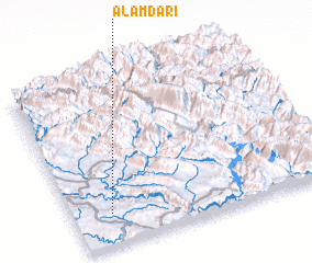 Places with similar names to ‘Alamdārī, Iran ::
// Além do Rio (PT)
// Além do Rio (PT)
// Além do Rio (PT)
// Além do Rio (PT)
// Além do Rio (PT)
// Além do Rio (PT)
// Além do Rio (PT)
// Além do Rio (PT)
// Além do Rio (PT)
// Alëmdar (TR)
Disclaimer :: Information on this page comes without warranty of any kind |
||
|
Where is ‘Alamdārī? Elevation and coordinates ::
Latitude (lat): 32°11'0"N Longitude (lon): 49°9'0"E
Elevation (approx.): 239m (map arrows pan, magnifying glasses zoom) |
||
|
Visiting ‘Alamdārī? Hotel/Accommodation ::
Book a hotel in ‘Alamdārī Travel Guide ::
Buy a travel guide for Iran rental cars ::
car rental offers GPS waypoint ::
download a GPX waypoint (PoI) of ‘Alamdārī for your GPS receiver
|
||