|
search place name
|
||
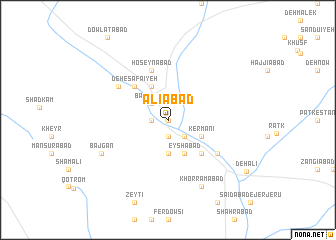
‘Alīābād (Iran)‘Alīābād is a town in Iran. An overview map of the region around ‘Alīābād is displayed below.
regional and 3d topo map of ‘Alīābād, Iran ::
‘Alīābād airports ::
The nearest airport is AZD - Yazd Shahid Sadooghi, located 164.9 km west of ‘Alīābād.
Other airports nearby include KER - Kerman (166.2 km south east), Nearby towns ::
Deh Now (0.0km north) //
Ḩoseynābād (0.0km north) //
Gorgīnābād (1.9km south) //
Mūrīābād (1.6km west) //
Akbarābād (1.6km west) //
Sheyţūr (2.5km north) //
Basāb (2.4km south east) //
Kabīrābād (2.4km north west) //
Bar Kūʼīyeh (2.4km north west) //
Seyyedābād (2.4km north west) //
Ḩakīmābād (2.4km north west) //
Mo'menābād (2.4km north west) //
Sharīfābād (3.7km south) //
Kamālābād (3.7km south east) //
Kermānī (3.7km south east) //
Ja‘farābād (4.0km south east) //
Eḩshāmābād (4.0km south east) //
‘Eyshābād (4.0km south east) //
Barkūh (4.0km north west) //
Fīrūzābād (4.9km south east) //
Deh-e Şafā'īyeh (4.9km north west) //
Ḩoseynābād (5.8km north) //
Noşratābād (6.0km south east) //
Deh-e Kūchek (6.0km north west) //
Khorramābād (8.1km south east) //
Bājgān (7.3km south west) //
Deh ‘Alī (9.4km south east) //
[all distances 'as the bird flies' and approximate]  Places with similar names to ‘Alīābād, Iran ::
Disclaimer :: Information on this page comes without warranty of any kind |
||
|
Where is ‘Alīābād? Elevation and coordinates ::
Latitude (lat): 31°30'0"N Longitude (lon): 55°57'0"E
Elevation (approx.): 1826m (map arrows pan, magnifying glasses zoom) |
||
|
Visiting ‘Alīābād? Hotel/Accommodation ::
Book a hotel in ‘Alīābād Travel Guide ::
Buy a travel guide for Iran rental cars ::
car rental offers GPS waypoint ::
download a GPX waypoint (PoI) of ‘Alīābād for your GPS receiver
|
||