|
search place name
|
||
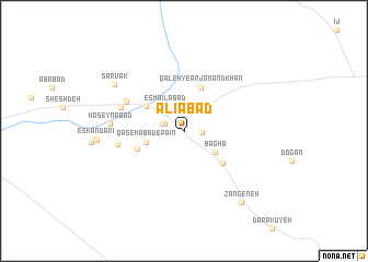
‘Alīābād (Fārs, Iran)‘Alīābād is a town in the Fārs region of Iran. An overview map of the region around ‘Alīābād is displayed below.
regional and 3d topo map of ‘Alīābād, Iran ::
‘Alīābād airports ::
The nearest airport is SYZ - Shiraz Shahid Dastghaib Intl, located 161.9 km north west of ‘Alīābād.
Nearby towns ::
Dīndārlū (1.6km east) //
Qāsemābād-e Bālā (1.9km west) //
Sākhtemān-e Arjmand (2.0km west) //
Esmā‘īlābād (3.1km north west) //
Kareh (3.1km north west) //
Baghā (3.5km south east) //
Qāsemābād-e Pā'īn (3.6km west) //
Vakīlābād (4.2km north west) //
Qal‘eh-ye Arjomand Khān (4.6km north) //
Kabkābād (4.5km south west) //
Jorgheh (4.8km south east) //
Nez̧āmābād (5.9km north west) //
Amīr Ḩājjīlū (5.9km north west) //
Akbarābād-e Shesh Deh (6.2km north west) //
‘Abbāsābād (6.1km west) //
Ḩoseynābād (6.7km west) //
Sarvak (7.8km north west) //
Zangeneh (9.0km south east) //
[all distances 'as the bird flies' and approximate] 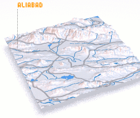 Places with similar names to ‘Alīābād, Iran ::
Disclaimer :: Information on this page comes without warranty of any kind |
||
|
Where is ‘Alīābād? Elevation and coordinates ::
Latitude (lat): 28°55'38"N Longitude (lon): 54°6'5"E
Elevation (approx.): 1397m (map arrows pan, magnifying glasses zoom) |
||
|
Visiting ‘Alīābād? Hotel/Accommodation ::
Book a hotel in ‘Alīābād Travel Guide ::
Buy a travel guide for Iran rental cars ::
car rental offers GPS waypoint ::
download a GPX waypoint (PoI) of ‘Alīābād for your GPS receiver
|
||