|
search place name
|
||
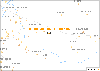
‘Alīābād-e Kalleh ‘Omar (Tehrān, Iran)‘Alīābād-e Kalleh ‘Omar is a town in the Tehrān region of Iran. An overview map of the region around ‘Alīābād-e Kalleh ‘Omar is displayed below.
regional and 3d topo map of ‘Alīābād-e Kalleh ‘Omar, Iran ::
‘Alīābād-e Kalleh ‘Omar airports ::
The nearest airport is THR - Teheran Mehrabad Intl, located 64.5 km north west of ‘Alīābād-e Kalleh ‘Omar.
Other airports nearby include RZR - Ramsar (204.3 km north west), Nearby towns ::
Qermez Tappeh (2.5km north west) //
‘Abdolābād (4.3km north west) //
Āfarīn (4.5km north west) //
‘Alīābād-e Kharābeh (4.3km west) //
Kahrīzak (4.7km west) //
Mandekān (4.9km south west) //
Ebrāhīmābād (5.2km north west) //
Khalīfābād (5.7km west) //
Ḩeşār Mehtar (6.8km west) //
Shūr (8.5km south) //
Yūsefābād (8.2km south west) //
Gandāb (8.4km north east) //
Golestānak (8.0km south east) //
Akbarābād (8.5km south west) //
Farajābād (8.4km south west) //
Qeshlāq-e Āfarīn (9.2km north west) //
Emāmzādeh ‘Alī (9.5km south west) //
[all distances 'as the bird flies' and approximate]  Places with similar names to ‘Alīābād-e Kalleh ‘Omar, Iran :: Disclaimer :: Information on this page comes without warranty of any kind |
||
|
Where is ‘Alīābād-e Kalleh ‘Omar? Elevation and coordinates ::
Latitude (lat): 35°21'21"N Longitude (lon): 51°53'45"E
Elevation (approx.): 968m (map arrows pan, magnifying glasses zoom) |
||
|
Visiting ‘Alīābād-e Kalleh ‘Omar? Hotel/Accommodation ::
Book a hotel in ‘Alīābād-e Kalleh ‘Omar Travel Guide ::
Buy a travel guide for Iran rental cars ::
car rental offers GPS waypoint ::
download a GPX waypoint (PoI) of ‘Alīābād-e Kalleh ‘Omar for your GPS receiver
|
||