|
search place name
|
||
‘Alīābād-e Karaftū (Kordestān, Iran)‘Alīābād-e Karaftū is a town in the Kordestān region of Iran. An overview map of the region around ‘Alīābād-e Karaftū is displayed below.
regional and 3d topo map of ‘Alīābād-e Karaftū, Iran ::

‘Alīābād-e Karaftū airports ::
The nearest airport is SDG - Sanandaj, located 114.6 km south of ‘Alīābād-e Karaftū.
Other airports nearby include TBZ - Tabriz Intl (213.6 km north), KSH - Bakhtaran Shahid Ashrafi Esfahani (215.4 km south), Nearby towns ::
Shojā‘ābād (1.9km south) //
Karaftū (3.7km north east) //
Kānī Sorkh (5.6km south) //
Sūlehkān (4.9km west) //
Aşḩāb (4.9km west) //
Torkaman Bolāgh (5.8km north east) //
Gūrbābā ‘Alī (5.9km south east) //
Darreh Pamdān (7.4km north) //
Bāyazīdābād (6.3km east) //
Āleyār (7.6km north) //
Qal‘ehgāh-e Sharīf (7.6km south) //
‘Alīmardeh (7.6km south) //
Bāshbolāgh (7.1km north west) //
Mas‘ūdābād (7.1km north east) //
Qal‘eh Kohneh (7.1km south east) //
Bardeh Rasheh (8.0km south) //
Karīmābād (8.7km north west) //
Malānsālār (9.5km south west) //
[all distances 'as the bird flies' and approximate] 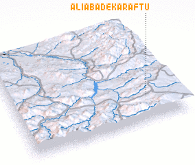 Places with similar names to ‘Alīābād-e Karaftū, Iran :: Disclaimer :: Information on this page comes without warranty of any kind |
||
|
Where is ‘Alīābād-e Karaftū? Elevation and coordinates ::
Latitude (lat): 36°16'0"N Longitude (lon): 46°49'0"E
Elevation (approx.): 2117m (map arrows pan, magnifying glasses zoom) |
||
|
Visiting ‘Alīābād-e Karaftū? Hotel/Accommodation ::
Book a hotel in ‘Alīābād-e Karaftū Travel Guide ::
Buy a travel guide for Iran rental cars ::
car rental offers GPS waypoint ::
download a GPX waypoint (PoI) of ‘Alīābād-e Karaftū for your GPS receiver
|
||