|
search place name
|
||
‘Alī Bolāgh (Ostān-e Kermānshāh, Iran)‘Alī Bolāgh is a town in the Ostān-e Kermānshāh region of Iran. An overview map of the region around ‘Alī Bolāgh is displayed below.
regional and 3d topo map of ‘Alī Bolāgh, Iran ::

‘Alī Bolāgh airports ::
The nearest airport is SDG - Sanandaj, located 70.9 km north west of ‘Alī Bolāgh.
Other airports nearby include KSH - Bakhtaran Shahid Ashrafi Esfahani (74.8 km south west), Nearby towns ::
Dār Ḩeydar (2.4km south east) //
Chongoreh (2.4km west) //
Kalegāh-e Zamān (3.0km north east) //
Ārānlah (3.6km south east) //
Khalajān (3.6km north east) //
Khānjamāl-e Panāhī (4.0km north) //
Khānjamāl-e Zamānī (4.0km north) //
Cheshmeh Cherāgh (4.6km west) //
Sahanleh (5.7km south) //
Palangīn (5.9km south east) //
Manşūr ‘Arab (6.3km north east) //
Bāvaleh (5.8km east) //
Heybatollāh (6.5km south west) //
Kīsaleh (7.7km north) //
Cham Kabūd (7.2km north west) //
Khowshyār (7.1km south west) //
Yūsofjerd (7.1km north east) //
Deh-e ‘Abbās (7.5km north west) //
Kamarābād (8.8km south east) //
Meykhowrān-e Moḩammad Şādeq (9.9km north east) //
[all distances 'as the bird flies' and approximate] 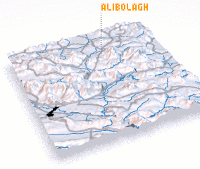 Places with similar names to ‘Alī Bolāgh, Iran ::
// ‘Alī Bolāgh (IR)
// ‘Alī Bolāghī (IR)
// ‘Alī Bolāghī (IR)
// ‘Alī Bolāghī (IR)
// ‘Alī Bolāghī (IR)
// ‘Alī Bolāghī (IR)
// Āl Bolāgh (IR)
// Āl Bolāgh (IR)
// Ālbolāgh (IR)
Disclaimer :: Information on this page comes without warranty of any kind |
||
|
Where is ‘Alī Bolāgh? Elevation and coordinates ::
Latitude (lat): 34°53'0"N Longitude (lon): 47°39'0"E
Elevation (approx.): 1925m (map arrows pan, magnifying glasses zoom) |
||
|
Visiting ‘Alī Bolāgh? Hotel/Accommodation ::
Book a hotel in ‘Alī Bolāgh Travel Guide ::
Buy a travel guide for Iran rental cars ::
car rental offers GPS waypoint ::
download a GPX waypoint (PoI) of ‘Alī Bolāgh for your GPS receiver
|
||