|
search place name
|
||
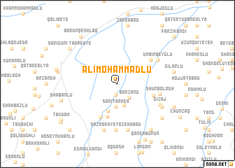
‘Alī Moḩammadlū (Ardabīl, Iran)‘Alī Moḩammadlū is a town in the Ardabīl region of Iran. An overview map of the region around ‘Alī Moḩammadlū is displayed below.
regional and 3d topo map of ‘Alī Moḩammadlū, Iran ::
‘Alī Moḩammadlū airports ::
The nearest airport is TBZ - Tabriz Intl, located 179.7 km south west of ‘Alī Moḩammadlū.
Other airports nearby include RAS - Rasht (240.9 km south east), Nearby towns ::
Shūsh Tappeh (1.8km south) //
Barzand (2.6km south east) //
Ebrāhīm Kandī (3.5km south) //
Sārī Tappeh (3.6km south) //
Nūrollāh Beyglū (4.5km south) //
Shahmār Beyglū (5.3km south) //
Qal‘eh Barzand (5.7km south) //
Jīn Kandī (4.8km south east) //
Beneh (5.6km north east) //
Shūr Bolāgh (5.5km east) //
Mazra‘eh-ye Tāzehābād (7.3km south) //
Dīzaj (6.2km south east) //
Ūnbīr Beyglū (6.3km north east) //
Mazra‘eh-ye ‘Alī Goshād (7.4km south) //
Tūsānlū-ye Barzand (7.5km south) //
Majīdlū (6.6km south east) //
Āngūrd (7.8km south east) //
Qāsem Kandī (8.4km south east) //
Borūn Qeshlāq (8.8km north west) //
Tappeh-ye Sārī Gūnī (8.2km north west) //
Qareh Būrūn (9.5km south) //
Dargāhlū (9.4km south west) //
[all distances 'as the bird flies' and approximate] 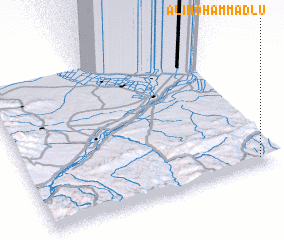 Places with similar names to ‘Alī Moḩammadlū, Iran ::
// Ali Muhammad Dal (PK)
// ‘Alī Moḩammadlū (IR)
Disclaimer :: Information on this page comes without warranty of any kind |
||
|
Where is ‘Alī Moḩammadlū? Elevation and coordinates ::
Latitude (lat): 39°2'57"N Longitude (lon): 47°56'9"E
Elevation (approx.): 824m (map arrows pan, magnifying glasses zoom) |
||
|
Visiting ‘Alī Moḩammadlū? Hotel/Accommodation ::
Book a hotel in ‘Alī Moḩammadlū Travel Guide ::
Buy a travel guide for Iran rental cars ::
car rental offers GPS waypoint ::
download a GPX waypoint (PoI) of ‘Alī Moḩammadlū for your GPS receiver
|
||