|
search place name
|
||
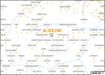
‘Alī Nez̧ām (Gīlān, Iran)‘Alī Nez̧ām is a town in the Gīlān region of Iran. An overview map of the region around ‘Alī Nez̧ām is displayed below.
regional and 3d topo map of ‘Alī Nez̧ām, Iran ::
‘Alī Nez̧ām airports ::
The nearest airport is RZR - Ramsar, located 48.7 km east of ‘Alī Nez̧ām.
Other airports nearby include RAS - Rasht (64.0 km north west), THR - Teheran Mehrabad Intl (174.0 km south east), Nearby towns ::
Ţalābon (1.5km east) //
Kavīj (1.5km east) //
Kām Kūh (2.4km south west) //
Shahr-e Somām (2.4km south west) //
Estakhreh (2.4km south east) //
Arbūr Dasht (3.0km west) //
Kejīd (3.7km south) //
Tāshkaleh (3.0km east) //
Sangbon (3.5km north west) //
Sheram Dasht (4.0km south) //
Darreh Qareh (4.0km north) //
Shīr ‘Alī (4.0km north) //
Arbūgardān (4.4km east) //
Karefkash (4.8km south west) //
Sangbon (4.8km north west) //
Khorāsān Poshteh (5.8km south) //
Emām (5.6km south west) //
Kākrūd (6.3km south west) //
Māzūbon (5.8km south east) //
Lāmshekan (5.8km south east) //
Amīrjān (5.8km north west) //
Khoshkeh Darreh (5.8km north east) //
Langar Kūh (5.9km east) //
Marjā Dasht (7.6km south) //
Langar Kūh (6.2km east) //
Lūdarābon (6.2km east) //
Halū Dasht (7.1km north west) //
Zarchāh (7.0km south west) //
Mīān Lengeh (7.0km north west) //
[all distances 'as the bird flies' and approximate] 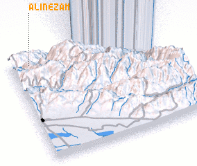 Places with similar names to ‘Alī Nez̧ām, Iran :: Disclaimer :: Information on this page comes without warranty of any kind |
||
|
Where is ‘Alī Nez̧ām? Elevation and coordinates ::
Latitude (lat): 36°56'0"N Longitude (lon): 50°8'0"E
Elevation (approx.): 1710m (map arrows pan, magnifying glasses zoom) |
||
|
Visiting ‘Alī Nez̧ām? Hotel/Accommodation ::
Book a hotel in ‘Alī Nez̧ām Travel Guide ::
Buy a travel guide for Iran rental cars ::
car rental offers GPS waypoint ::
download a GPX waypoint (PoI) of ‘Alī Nez̧ām for your GPS receiver
|
||