|
search place name
|
||
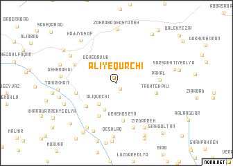
‘Alī-ye Qūrchī (Iran)‘Alī-ye Qūrchī is a town in Iran. An overview map of the region around ‘Alī-ye Qūrchī is displayed below.
regional and 3d topo map of ‘Alī-ye Qūrchī, Iran ::
‘Alī-ye Qūrchī airports ::
The nearest airport is QMJ - Masjed Soleiman Shahid Asyaee, located 201.0 km south of ‘Alī-ye Qūrchī.
Nearby towns ::
Chāl Homā (1.0km south east) //
Deh-e Dāvūd (4.0km north west) //
‘Alī Qūrchī (4.2km south west) //
Qāʼīdān (4.6km south) //
Chahār Bāgh (5.8km south west) //
Hendūdar (5.5km south west) //
Deh-e Ḩoseyn (6.2km south) //
Takhteh Pīlī (5.6km east) //
Rostam Darsī (5.7km west) //
Pākal (5.8km east) //
Deh-e Kows̄ar (6.3km north west) //
Panj Zowj (7.5km south) //
Zīrdarreh (8.1km south east) //
Khenā Darreh-ye Vosţá (8.2km south west) //
Āqcheh Bolāgh (7.6km north west) //
Deh-e Kalbī (8.4km south) //
Z̧ohrābād-e Āstāneh (8.7km north) //
Qeshlāq (8.7km south) //
Ḩājj Yūsof (8.4km north west) //
Khamestān (7.8km south west) //
Deh-e Āqā (9.3km south east) //
Areklū (9.2km south west) //
Qal‘eh-ye Āqā Ḩamīd (9.2km north east) //
Khanādarreh-ye Soflá (9.0km south west) //
Āq Bolāgh-e Sādāt (8.9km north west) //
Qal‘eh-ye Bālemān (10.2km north east) //
Sīāh Solţān (10.2km south east) //
[all distances 'as the bird flies' and approximate] 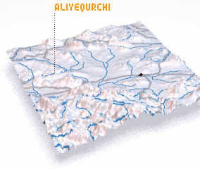 Places with similar names to ‘Alī-ye Qūrchī, Iran :: Disclaimer :: Information on this page comes without warranty of any kind |
||
|
Where is ‘Alī-ye Qūrchī? Elevation and coordinates ::
Latitude (lat): 33°48'52"N Longitude (lon): 49°16'33"E
Elevation (approx.): 2241m (map arrows pan, magnifying glasses zoom) |
||
|
Visiting ‘Alī-ye Qūrchī? Hotel/Accommodation ::
Book a hotel in ‘Alī-ye Qūrchī Travel Guide ::
Buy a travel guide for Iran rental cars ::
car rental offers GPS waypoint ::
download a GPX waypoint (PoI) of ‘Alī-ye Qūrchī for your GPS receiver
|
||