|
search place name
|
||
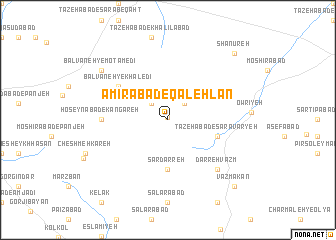
Amīrābād-e Qal‘ehlān (Ostān-e Kermānshāh, Iran)Amīrābād-e Qal‘ehlān is a town in the Ostān-e Kermānshāh region of Iran. An overview map of the region around Amīrābād-e Qal‘ehlān is displayed below.
regional and 3d topo map of Amīrābād-e Qal‘ehlān, Iran ::
Amīrābād-e Qal‘ehlān airports ::
The nearest airport is SDG - Sanandaj, located 59.1 km west of Amīrābād-e Qal‘ehlān.
Other airports nearby include KSH - Bakhtaran Shahid Ashrafi Esfahani (94.3 km south west), Nearby towns ::
Tāzehābād-e Owrīyeh (0.3km north) //
Tāzehābād-e Jāmeh Shūrān (2.4km north west) //
Jāmeh Shūrān (2.4km north west) //
Pīr Bābā ‘Alī (2.4km north east) //
Sar Darreh (5.6km south) //
Tāzehābād-e Sarāvaryeh (4.9km east) //
Bālvāneh-ye Khāledī (5.9km north west) //
Ḩoseynābād-e Kangareh (6.1km west) //
Darreh Vazm (7.2km south east) //
Taqīābād (8.2km north west) //
Bālvāneh-ye Mo‘tamedī (8.2km north west) //
Vazmakān (9.6km south east) //
Shānūreh (9.6km north east) //
[all distances 'as the bird flies' and approximate] 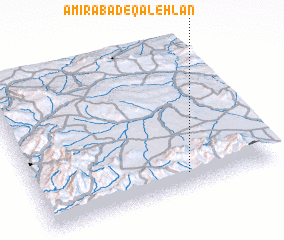 Places with similar names to Amīrābād-e Qal‘ehlān, Iran :: Disclaimer :: Information on this page comes without warranty of any kind |
||
|
Where is Amīrābād-e Qal‘ehlān? Elevation and coordinates ::
Latitude (lat): 35°6'0"N Longitude (lon): 47°38'0"E
Elevation (approx.): 2058m (map arrows pan, magnifying glasses zoom) |
||
|
Visiting Amīrābād-e Qal‘ehlān? Hotel/Accommodation ::
Book a hotel in Amīrābād-e Qal‘ehlān Travel Guide ::
Buy a travel guide for Iran rental cars ::
car rental offers GPS waypoint ::
download a GPX waypoint (PoI) of Amīrābād-e Qal‘ehlān for your GPS receiver
|
||