|
search place name
|
||
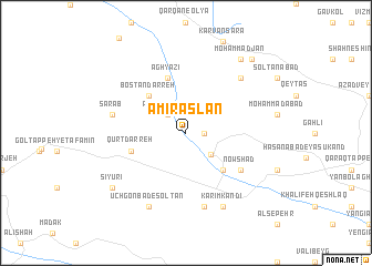
Amīr Aşlān (Kordestān, Iran)Amīr Aşlān is a town in the Kordestān region of Iran. An overview map of the region around Amīr Aşlān is displayed below.
regional and 3d topo map of Amīr Aşlān, Iran ::
Amīr Aşlān airports ::
The nearest airport is SDG - Sanandaj, located 129.9 km south west of Amīr Aşlān.
Other airports nearby include RAS - Rasht (209.6 km north east), KSH - Bakhtaran Shahid Ashrafi Esfahani (221.1 km south), TBZ - Tabriz Intl (238.4 km north west), Nearby towns ::
Seyf‘alī Kandī (1.5km east) //
Rostam Kandī (2.4km north west) //
Yengīābād (3.0km south east) //
Bostān Darreh (4.8km north west) //
Nūr Moḩammad Kandī (4.8km south east) //
Āghyāzī (5.8km north) //
Qūrt Darreh (4.8km west) //
Nowshād (5.8km south east) //
Sarāb (6.3km west) //
Dādāsh Kandī (7.6km south) //
Maḩmūdābād (7.1km north east) //
Ūchgonbad-e Khān (8.0km south) //
Ūchgonbad-e Solţān (8.0km south) //
Karīm Kandī (8.0km south) //
Sīyūrī (8.2km south west) //
Moḩammad Jān (8.7km north east) //
Qezel Tappeh (9.1km north east) //
[all distances 'as the bird flies' and approximate] 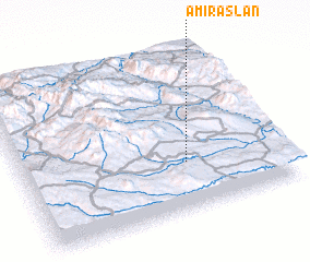 Places with similar names to Amīr Aşlān, Iran :: Disclaimer :: Information on this page comes without warranty of any kind |
||
|
Where is Amīr Aşlān? Elevation and coordinates ::
Latitude (lat): 36°18'0"N Longitude (lon): 47°38'0"E
Elevation (approx.): 1693m (map arrows pan, magnifying glasses zoom) |
||
|
Visiting Amīr Aşlān? Hotel/Accommodation ::
Book a hotel in Amīr Aşlān Travel Guide ::
Buy a travel guide for Iran rental cars ::
car rental offers GPS waypoint ::
download a GPX waypoint (PoI) of Amīr Aşlān for your GPS receiver
|
||