|
search place name
|
||
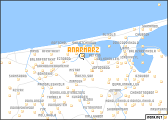
Anārmarz (Iran)Anārmarz is a town in Iran. An overview map of the region around Anārmarz is displayed below.
regional and 3d topo map of Anārmarz, Iran ::
Anārmarz airports ::
The nearest airport is THR - Teheran Mehrabad Intl, located 178.3 km south west of Anārmarz.
Nearby towns ::
Lāk Dasht (1.7km east) //
Labū Şaḩrā (1.8km north west) //
Peţrūd (2.0km east) //
Dūnchāl (2.7km south east) //
Anbārsar (2.9km north) //
Shīlāt Chīkrūd (3.1km north) //
Bīkārāpas (3.0km south east) //
Mīstān (3.4km south west) //
Kar Fūn (3.1km north west) //
Mīān Melk (3.6km north east) //
Laktash (4.4km south) //
Manzel Sar (4.4km south) //
Eznābād (3.6km west) //
Ja‘farābād (4.0km south east) //
Bālā Z̄oghālī Manzel (4.6km south) //
Gel Maḩalleh (4.4km east) //
Mīān Deh (5.7km south) //
Naft Chāl (5.3km north west) //
Talnār (5.5km north east) //
Rowshandān (6.0km south west) //
Dārāb Dīn-e Bahnemīr (5.9km west) //
Shahneh Kola (6.8km south west) //
Seyyed Zeyn ol ‘Ābedīn (6.3km south east) //
Pā'īn Esmā'īl Kolā (7.1km south) //
Pā'īn Afrā Takht (5.9km west) //
Afrātakht (5.9km west) //
‘Alī Kolā (6.7km north east) //
Āstāneh Sar (6.8km south east) //
Kūseh Maḩalleh (6.1km east) //
[all distances 'as the bird flies' and approximate] 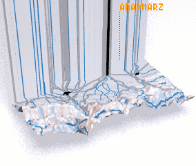 Places with similar names to Anārmarz, Iran :: Disclaimer :: Information on this page comes without warranty of any kind |
||
|
Where is Anārmarz? Elevation and coordinates ::
Latitude (lat): 36°42'21"N Longitude (lon): 52°50'55"E
Elevation (approx.): -20m (map arrows pan, magnifying glasses zoom) |
||
|
Visiting Anārmarz? Hotel/Accommodation ::
Book a hotel in Anārmarz Travel Guide ::
Buy a travel guide for Iran rental cars ::
car rental offers GPS waypoint ::
download a GPX waypoint (PoI) of Anārmarz for your GPS receiver
|
||