|
search place name
|
||
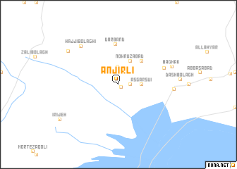
Anjīrlī (Iran)Anjīrlī is a town in Iran. An overview map of the region around Anjīrlī is displayed below.
regional and 3d topo map of Anjīrlī, Iran ::
Anjīrlī airports ::
The nearest airport is THR - Teheran Mehrabad Intl, located 77.9 km north east of Anjīrlī.
Other airports nearby include RZR - Ramsar (199.4 km north), Nearby towns ::
Īlkh Bolāghī (0.5km south east) //
Ne‘matābād (1.5km east) //
Kūshk-e Bahrām (2.8km north) //
‘Asgar Sū'ī (3.0km east) //
Nowrūzābād (4.0km north) //
Neyzār (4.8km north east) //
Darband (6.4km north) //
Dūlāy Qārqī (6.4km north east) //
Ḩājjī Bolāghī (7.8km north west) //
Kūshk-e Noşrat (7.3km east) //
Bāghak (7.4km east) //
Qeshlāq-e Ḩājjī Bolāgh (8.3km north west) //
[all distances 'as the bird flies' and approximate]  Places with similar names to Anjīrlī, Iran ::
Disclaimer :: Information on this page comes without warranty of any kind |
||
|
Where is Anjīrlī? Elevation and coordinates ::
Latitude (lat): 35°7'0"N Longitude (lon): 50°49'0"E
Elevation (approx.): 1046m (map arrows pan, magnifying glasses zoom) |
||
|
Visiting Anjīrlī? Hotel/Accommodation ::
Book a hotel in Anjīrlī Travel Guide ::
Buy a travel guide for Iran rental cars ::
car rental offers GPS waypoint ::
download a GPX waypoint (PoI) of Anjīrlī for your GPS receiver
|
||