|
search place name
|
||
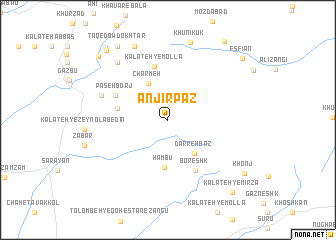
Anjīr Paz (Khorāsān, Iran)Anjīr Paz is a town in the Khorāsān region of Iran. An overview map of the region around Anjīr Paz is displayed below.
regional and 3d topo map of Anjīr Paz, Iran ::
Anjīr Paz airports ::
The nearest airport is XBJ - Birjand, located 126.6 km south east of Anjīr Paz.
Nearby towns ::
Charmeh (4.5km north west) //
Darreh Bāz (4.4km south east) //
Hambū (5.4km south) //
Paseh Borj (4.9km west) //
Pas Borj (4.9km west) //
Kalāteh-ye Mollā (6.1km north) //
Boreshk (6.1km south east) //
Paseh Borj (5.6km north west) //
Now Khān (6.8km north west) //
Marghzār (7.9km north west) //
Khūnīkūk (8.9km north) //
Mīāntak (8.8km north) //
Khavār (9.5km north west) //
Ţāq-e Dow Dokhtar (9.5km north west) //
Garneshk (9.6km north west) //
Khonj (9.3km south east) //
Sarāb (9.6km north west) //
Abā Manşūrī (9.9km north west) //
Khāneh-ye Kūk (10.1km north east) //
Esfīān (9.7km north east) //
Kalāteh-ye Mīrzā (10.1km south east) //
[all distances 'as the bird flies' and approximate] 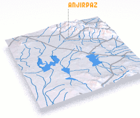 Places with similar names to Anjīr Paz, Iran :: Disclaimer :: Information on this page comes without warranty of any kind |
||
|
Where is Anjīr Paz? Elevation and coordinates ::
Latitude (lat): 33°54'33"N Longitude (lon): 58°38'2"E
Elevation (approx.): 2355m (map arrows pan, magnifying glasses zoom) |
||
|
Visiting Anjīr Paz? Hotel/Accommodation ::
Book a hotel in Anjīr Paz Travel Guide ::
Buy a travel guide for Iran rental cars ::
car rental offers GPS waypoint ::
download a GPX waypoint (PoI) of Anjīr Paz for your GPS receiver
|
||