|
search place name
|
||
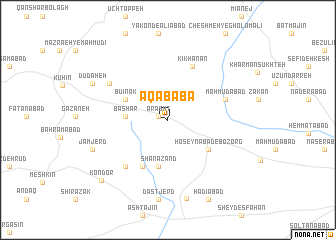
Āqā Bābā (Iran)Āqā Bābā is a town in Iran. An overview map of the region around Āqā Bābā is displayed below.
regional and 3d topo map of Āqā Bābā, Iran ::
Āqā Bābā airports ::
The nearest airport is RZR - Ramsar, located 103.3 km north east of Āqā Bābā.
Other airports nearby include RAS - Rasht (111.5 km north), THR - Teheran Mehrabad Intl (155.8 km south east), Nearby towns ::
Arasht (0.9km north west) //
Bashar (3.8km west) //
Būʼīnak (4.4km north west) //
Rāmoshān (5.2km south) //
Shanāzand (5.2km south) //
Ḩoseynābād-e Bozorg (4.9km south east) //
Senjānak (5.7km south west) //
Kīkhanān (6.3km north) //
Maḩmūdābād (5.6km north east) //
Aḩmadābād-e Ūfān (6.4km south west) //
Bechīnak (6.7km north west) //
Dastjerd (8.9km south) //
Dāghlān (8.9km south) //
Jam Jerd (7.6km south west) //
Dūdaheh (7.9km north west) //
Hādīābād (9.6km south) //
Kondor (9.0km south west) //
[all distances 'as the bird flies' and approximate] 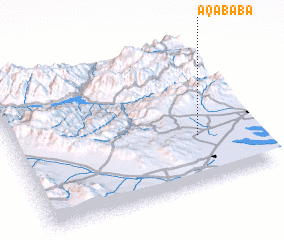 Places with similar names to Āqā Bābā, Iran ::
Disclaimer :: Information on this page comes without warranty of any kind |
||
|
Where is Āqā Bābā? Elevation and coordinates ::
Latitude (lat): 36°19'47"N Longitude (lon): 49°46'33"E
Elevation (approx.): 1413m (map arrows pan, magnifying glasses zoom) |
||
|
Visiting Āqā Bābā? Hotel/Accommodation ::
Book a hotel in Āqā Bābā Travel Guide ::
Buy a travel guide for Iran rental cars ::
car rental offers GPS waypoint ::
download a GPX waypoint (PoI) of Āqā Bābā for your GPS receiver
|
||