|
search place name
|
||
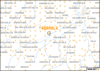
Āqā Molk (Iran)Āqā Molk is a town in Iran. An overview map of the region around Āqā Molk is displayed below.
regional and 3d topo map of Āqā Molk, Iran ::
Āqā Molk airports ::
The nearest airport is THR - Teheran Mehrabad Intl, located 142.1 km south west of Āqā Molk.
Other airports nearby include RZR - Ramsar (175.7 km west), Nearby towns ::
Bābalkān-e Bālā (1.9km north) //
Darzī Kolā Kūchak (1.5km east) //
Āqā Shafī‘ (1.9km south) //
Delāvar Kolā (1.9km south) //
Qaşşāb Kolā (1.9km south) //
Darzī Kolā-ye Āqā Shafī‘ (1.9km south) //
Chāleh Polī (1.5km west) //
Geleh Maḩalleh (1.5km west) //
Andī Kolā (2.5km north) //
Kharjī Kolā (2.4km north east) //
Āgtījkolā (2.4km north east) //
‘Ālī Zamīn (2.4km south east) //
Dāvūd Kolā (2.4km north west) //
Bālā Aḩmad Chāleh Pey (2.4km south west) //
Bālā Chāleh (2.4km south west) //
Qāẕī Maḩalleh (3.7km north) //
Matekeh (3.7km north) //
Varmatūn (3.7km north) //
Bābalkān-e Pā'īn (3.7km north) //
Aleh Chāl (3.9km south) //
Bālā Andī Kolā (3.4km north west) //
Pāʼīn Aḩmad Chāleh Pey (3.5km north east) //
Khorāsān Maḩalleh (3.5km north east) //
Khān Rū Posht (4.0km north) //
Garmīch (4.0km north) //
Shāyeb Kolā (3.5km south east) //
Pā'īn Karū Kolā (4.0km north) //
Bālā Karū Kolā (4.0km north) //
Kerū Kolā (4.0km north) //
[all distances 'as the bird flies' and approximate] 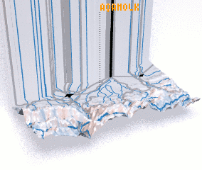 Places with similar names to Āqā Molk, Iran ::
Disclaimer :: Information on this page comes without warranty of any kind |
||
|
Where is Āqā Molk? Elevation and coordinates ::
Latitude (lat): 36°28'0"N Longitude (lon): 52°34'0"E
Elevation (approx.): 13m (map arrows pan, magnifying glasses zoom) |
||
|
Visiting Āqā Molk? Hotel/Accommodation ::
Book a hotel in Āqā Molk Travel Guide ::
Buy a travel guide for Iran rental cars ::
car rental offers GPS waypoint ::
download a GPX waypoint (PoI) of Āqā Molk for your GPS receiver
|
||