|
search place name
|
||
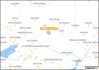
‘Arabābād (Tehrān, Iran)‘Arabābād is a town in the Tehrān region of Iran. An overview map of the region around ‘Arabābād is displayed below.
regional and 3d topo map of ‘Arabābād, Iran ::
‘Arabābād airports ::
The nearest airport is THR - Teheran Mehrabad Intl, located 68.8 km south east of ‘Arabābād.
Other airports nearby include RZR - Ramsar (99.1 km north), RAS - Rasht (173.4 km north west), Nearby towns ::
Hīv (3.1km north west) //
Khūr (3.7km east) //
Shelamzār (5.3km north) //
Sefīdārak (5.8km north east) //
Şāleḩābād (6.2km south west) //
Īstgāh-e Rāh Āhan-e Hashtgerd (6.8km south west) //
Askanān (7.2km north west) //
Mehdīābād (7.1km south west) //
‘Alīābād (8.1km south west) //
Kūshk-e Zar-e Jadīd (9.2km south west) //
Hashtgerd (8.9km south west) //
Ḩoseynābād (9.3km south east) //
Yengī Emām (9.7km south west) //
Qal‘eh-ye Bālā (10.0km south west) //
Dangīzak (10.0km south west) //
Qal‘eh-ye Āz̄arī (9.9km south west) //
Ḩasanābād (10.4km south west) //
Ḩoseynābād (10.7km south west) //
Kūreh-ye Moqaddam (11.1km south west) //
[all distances 'as the bird flies' and approximate] 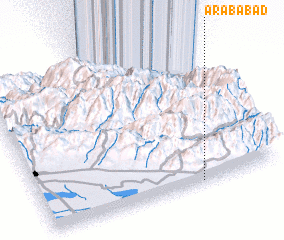 Places with similar names to ‘Arabābād, Iran ::
Disclaimer :: Information on this page comes without warranty of any kind |
||
|
Where is ‘Arabābād? Elevation and coordinates ::
Latitude (lat): 36°1'0"N Longitude (lon): 50°40'0"E
Elevation (approx.): 1436m (map arrows pan, magnifying glasses zoom) |
||
|
Visiting ‘Arabābād? Hotel/Accommodation ::
Book a hotel in ‘Arabābād Travel Guide ::
Buy a travel guide for Iran rental cars ::
car rental offers GPS waypoint ::
download a GPX waypoint (PoI) of ‘Arabābād for your GPS receiver
|
||