|
search place name
|
||
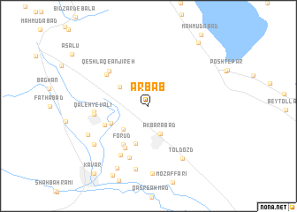
Arbāb (Fārs, Iran)Arbāb is a town in the Fārs region of Iran. An overview map of the region around Arbāb is displayed below.
regional and 3d topo map of Arbāb, Iran ::
Arbāb airports ::
The nearest airport is SYZ - Shiraz Shahid Dastghaib Intl, located 33.5 km north west of Arbāb.
Other airports nearby include BUZ - Bushehr (191.1 km west), Nearby towns ::
Akbarābād (3.8km south) //
Būrakī (3.9km north west) //
Qal‘eh-ye Shūlī (4.0km south west) //
Arbābī (5.0km south) //
Maḩmūdābād-e Seh Dāngeh (4.7km south west) //
Forūd (5.5km south west) //
Maḩmūdābād-e Yek Dāngeh (5.3km south west) //
Pārū (5.9km south west) //
Shāhābād (6.1km north west) //
Qeshlāq-e Anjīreh (6.2km north west) //
Zījerd (6.8km south) //
Qal‘eh-ye Valī (6.1km west) //
Ţasūj (6.1km west) //
Qal‘eh-ye Mīrzā'ī (6.9km south west) //
Tol Dozd (7.6km south east) //
Nowrūzān (8.1km south) //
Shāh-e Shahīdān (7.7km south west) //
Maḩmūdābād-e Do Dāngeh (7.6km south west) //
Qal‘eh-ye Jadīd (8.5km south) //
Dashtak (8.6km south west) //
Kavār (9.7km south west) //
Mahārlū (9.7km north east) //
Kavār (10.4km south west) //
[all distances 'as the bird flies' and approximate] 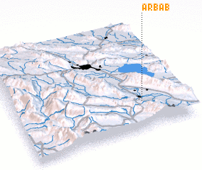 Places with similar names to Arbāb, Iran ::
Disclaimer :: Information on this page comes without warranty of any kind |
||
|
Where is Arbāb? Elevation and coordinates ::
Latitude (lat): 29°16'36"N Longitude (lon): 52°45'42"E
Elevation (approx.): 1579m (map arrows pan, magnifying glasses zoom) |
||
|
Visiting Arbāb? Hotel/Accommodation ::
Book a hotel in Arbāb Travel Guide ::
Buy a travel guide for Iran rental cars ::
car rental offers GPS waypoint ::
download a GPX waypoint (PoI) of Arbāb for your GPS receiver
|
||