|
search place name
|
||
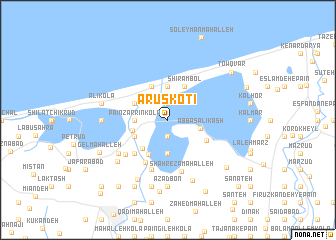
‘Arūs Kotī (Iran)‘Arūs Kotī is a town in Iran. An overview map of the region around ‘Arūs Kotī is displayed below.
regional and 3d topo map of ‘Arūs Kotī, Iran ::
‘Arūs Kotī airports ::
The nearest airport is THR - Teheran Mehrabad Intl, located 188.5 km south west of ‘Arūs Kotī.
Nearby towns ::
Zarrīn Kolā-ye Pā'īn (1.9km south) //
Bālā Zarrīn Kolā (1.9km south) //
Chūbāgh (1.9km north) //
Zarrīn Kolā-ye Bālā (3.7km south) //
Pā'īn Zarrīn Kolā (3.0km west) //
Lārīm Dahaneh (3.7km north) //
‘Abbās ‘Alī Kash (3.0km east) //
Lārīm (3.4km west) //
Khvor Deh Lārīm (3.5km south west) //
Shīrāmbol (4.0km north) //
Emāmzādeh Maḩmūd (3.5km north west) //
Shīlāt Lārīm (4.0km north) //
Īzadī Kheyl (4.0km south west) //
Zīār Maḩalleh (4.3km south west) //
Seyyed Maḩalleh (4.1km south east) //
Khūz Deh (4.8km south west) //
Rangrīz Maḩalleh (4.8km south west) //
Kord Kheyl (5.2km south west) //
Meshkābād-e Bālā (5.8km south) //
Chahār Shanbeh Bāzār (5.8km south) //
Kīā Maḩalleh (5.8km south) //
Shāh Reẕā Maḩalleh (5.9km south) //
Kord Kolā (5.4km south west) //
Kūseh Maḩalleh (5.8km south west) //
Kūhī Kheyl (6.5km south west) //
Tālārak (7.1km south) //
Āzād Bon (7.4km south) //
Talnār (5.9km west) //
Shūrkā (7.2km south west) //
[all distances 'as the bird flies' and approximate] 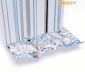 Places with similar names to ‘Arūs Kotī, Iran ::
Disclaimer :: Information on this page comes without warranty of any kind |
||
|
Where is ‘Arūs Kotī? Elevation and coordinates ::
Latitude (lat): 36°44'0"N Longitude (lon): 52°58'0"E
Elevation (approx.): -22m (map arrows pan, magnifying glasses zoom) |
||
|
Visiting ‘Arūs Kotī? Hotel/Accommodation ::
Book a hotel in ‘Arūs Kotī Travel Guide ::
Buy a travel guide for Iran rental cars ::
car rental offers GPS waypoint ::
download a GPX waypoint (PoI) of ‘Arūs Kotī for your GPS receiver
|
||