|
search place name
|
||
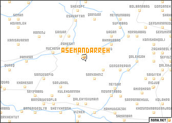
Āsemān Darreh (Kordestān, Iran)Āsemān Darreh is a town in the Kordestān region of Iran. An overview map of the region around Āsemān Darreh is displayed below.
regional and 3d topo map of Āsemān Darreh, Iran ::
Āsemān Darreh airports ::
The nearest airport is SDG - Sanandaj, located 30.2 km north west of Āsemān Darreh.
Other airports nearby include KSH - Bakhtaran Shahid Ashrafi Esfahani (76.5 km south), Nearby towns ::
Kīleh Golān (1.3km north west) //
Kelīleh Galān (1.9km north) //
Amīrābād (2.4km north west) //
Sarkahrīz (4.0km south) //
Varmakān (3.6km south east) //
Kheyrābād (3.6km north east) //
Ramesht (4.4km north west) //
Moḩammadābād-e Karīān (6.3km north west) //
Aḩmadābād (5.9km north east) //
Mūchesh (6.2km west) //
Gerger-e Pāʼīn (6.3km east) //
Gāʼīdar (7.2km north west) //
Sar Jamāl (7.2km south west) //
Dagan (7.2km north east) //
Kūleh Darrah (8.0km south) //
Neydar (7.8km south east) //
Noşratābād (8.7km south east) //
Şūfīābād (9.6km north east) //
Gholāmābād (9.6km north east) //
Bākhorram-e Soflá (9.6km south west) //
Gerger-e Soflá (9.7km south east) //
[all distances 'as the bird flies' and approximate] 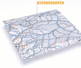 Places with similar names to Āsemān Darreh, Iran ::
// Asmandara (UZ)
Disclaimer :: Information on this page comes without warranty of any kind |
||
|
Where is Āsemān Darreh? Elevation and coordinates ::
Latitude (lat): 35°2'0"N Longitude (lon): 47°13'0"E
Elevation (approx.): 1834m (map arrows pan, magnifying glasses zoom) |
||
|
Visiting Āsemān Darreh? Hotel/Accommodation ::
Book a hotel in Āsemān Darreh Travel Guide ::
Buy a travel guide for Iran rental cars ::
car rental offers GPS waypoint ::
download a GPX waypoint (PoI) of Āsemān Darreh for your GPS receiver
|
||