|
search place name
|
||
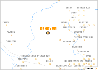
‘Ashāyerī (Khūzestān, Iran)‘Ashāyerī is a town in the Khūzestān region of Iran. An overview map of the region around ‘Ashāyerī is displayed below.
regional and 3d topo map of ‘Ashāyerī, Iran ::
‘Ashāyerī airports ::
The nearest airport is QMJ - Masjed Soleiman Shahid Asyaee, located 141.6 km south east of ‘Ashāyerī.
Other airports nearby include AWZ - Ahwaz (180.0 km south), KSH - Bakhtaran Shahid Ashrafi Esfahani (187.9 km north west), Nearby towns ::
Kharman-e Jāsūkhteh (3.9km south east) //
Sheykh (6.3km north east) //
Takht-e Sefīd (6.9km east) //
Deh Sīr (6.9km east) //
Chāvanī Bāhār Āb (6.9km east) //
Māyārān (6.9km east) //
Gardāb-e Yek (7.5km south east) //
Gardāb-e Do (7.5km south east) //
Chāvanī Ābgūn (7.6km north east) //
Āhū Barand (8.6km north east) //
[all distances 'as the bird flies' and approximate] 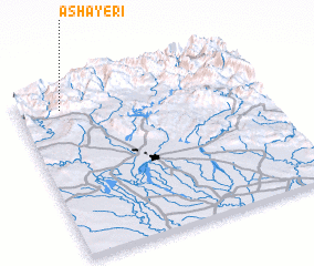 Places with similar names to ‘Ashāyerī, Iran :: Disclaimer :: Information on this page comes without warranty of any kind |
||
|
Where is ‘Ashāyerī? Elevation and coordinates ::
Latitude (lat): 32°52'59"N Longitude (lon): 48°10'46"E
Elevation (approx.): 1375m (map arrows pan, magnifying glasses zoom) |
||
|
Visiting ‘Ashāyerī? Hotel/Accommodation ::
Book a hotel in ‘Ashāyerī Travel Guide ::
Buy a travel guide for Iran rental cars ::
car rental offers GPS waypoint ::
download a GPX waypoint (PoI) of ‘Ashāyerī for your GPS receiver
|
||