|
search place name
|
||
Āsīāb Sar (Iran)Āsīāb Sar is a town in Iran. An overview map of the region around Āsīāb Sar is displayed below.
regional and 3d topo map of Āsīāb Sar, Iran ::

Āsīāb Sar airports ::
The nearest airport is THR - Teheran Mehrabad Intl, located 78.0 km south of Āsīāb Sar.
Other airports nearby include RZR - Ramsar (90.3 km north west), RAS - Rasht (194.9 km north west), Nearby towns ::
Sūt Kalam (0.0km north) //
Na‘l-e Tāzehābād (1.5km east) //
Nāşerābād (2.4km north east) //
Palanj (4.0km south) //
Vennen (3.5km north west) //
Dasht-e Naz̧īr (3.6km north west) //
Chetan (3.8km west) //
Chītan (4.7km south east) //
Hezār Som (4.8km north west) //
Kīā (4.8km east) //
Sheykh Kolā (4.8km north west) //
Manjīr (5.2km south west) //
Samā' (5.3km west) //
Napar (6.3km north west) //
Eslāmābād (6.1km east) //
Kīkūh (7.1km south west) //
Qal‘eh Bon (7.1km south west) //
‘Ālī Darreh (8.0km north) //
Āl Darreh (8.0km north) //
Kīnj (7.1km east) //
Emāmzādeh Shāhpīr (9.5km south west) //
[all distances 'as the bird flies' and approximate] 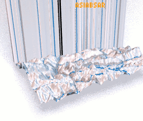 Places with similar names to Āsīāb Sar, Iran ::
Disclaimer :: Information on this page comes without warranty of any kind |
||
|
Where is Āsīāb Sar? Elevation and coordinates ::
Latitude (lat): 36°23'0"N Longitude (lon): 51°27'0"E
Elevation (approx.): 1614m (map arrows pan, magnifying glasses zoom) |
||
|
Visiting Āsīāb Sar? Hotel/Accommodation ::
Book a hotel in Āsīāb Sar Travel Guide ::
Buy a travel guide for Iran rental cars ::
car rental offers GPS waypoint ::
download a GPX waypoint (PoI) of Āsīāb Sar for your GPS receiver
|
||