|
search place name
|
||
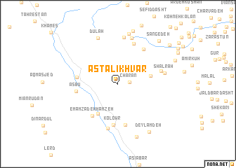
Asţalīkhvār (Ardabīl, Iran)Asţalīkhvār is a town in the Ardabīl region of Iran. An overview map of the region around Asţalīkhvār is displayed below.
regional and 3d topo map of Asţalīkhvār, Iran ::
Asţalīkhvār airports ::
The nearest airport is RAS - Rasht, located 79.2 km east of Asţalīkhvār.
Other airports nearby include RZR - Ramsar (183.6 km east), Nearby towns ::
Chārān (1.5km east) //
Hafteh Khūnī (4.3km east) //
Derow (5.4km south west) //
Emāmzādeh Ḩamzeh (6.1km south west) //
Askestān (5.3km west) //
Ākhūnd Maḩalleh (6.6km south) //
Kolowr (6.6km south) //
Asbū (5.4km west) //
Asţalkhvār (6.4km north east) //
Bārkā Zamīn (6.8km north) //
Dasht Dāman (5.9km east) //
Emāmzādeh ‘Abdollāh (7.2km south) //
Karehkhvār (7.5km north) //
Mūsheh Lakeh (7.5km north) //
Shāl Rāh (6.1km east) //
Dūlah (7.7km north) //
Mīsheh Chāl (8.2km north) //
Şāleḩ (8.7km north) //
Bāgh-e Zarrīn Kaff (8.8km south) //
Deylamdeh (8.6km south east) //
Sangedeh (8.7km north east) //
Dāsht Dāmān (9.0km north east) //
[all distances 'as the bird flies' and approximate] 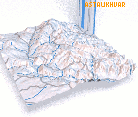 Places with similar names to Asţalīkhvār, Iran ::
// Asţalkhvār (IR)
Disclaimer :: Information on this page comes without warranty of any kind |
||
|
Where is Asţalīkhvār? Elevation and coordinates ::
Latitude (lat): 37°26'52"N Longitude (lon): 48°43'29"E
Elevation (approx.): 2516m (map arrows pan, magnifying glasses zoom) |
||
|
Visiting Asţalīkhvār? Hotel/Accommodation ::
Book a hotel in Asţalīkhvār Travel Guide ::
Buy a travel guide for Iran rental cars ::
car rental offers GPS waypoint ::
download a GPX waypoint (PoI) of Asţalīkhvār for your GPS receiver
|
||