|
search place name
|
||
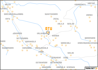
Atū (Iran)Atū is a town in Iran. An overview map of the region around Atū is displayed below.
regional and 3d topo map of Atū, Iran ::
Atū airports ::
The nearest airport is THR - Teheran Mehrabad Intl, located 164.5 km west of Atū.
Nearby towns ::
Kendelek (0.9km west) //
Amīr Kolā (1.6km south west) //
Sī Pey (2.3km south east) //
Pīr Na‘īm (2.3km south east) //
Valū Kash (2.3km west) //
Kochīd (3.1km south) //
Bahmanān (2.8km south west) //
Mateh Kolā (4.6km south east) //
Pāshā Kolā (4.6km south east) //
Lowlāk-e Kaslīān (4.5km south east) //
Valīlā (5.0km north east) //
Zazūl (5.7km north east) //
Jāyrūn (5.5km south west) //
Sang Nīsht (5.5km south east) //
Qādī Kola (5.8km south west) //
Chendelā (6.3km south) //
Khvājeh Kolā (6.3km south) //
Lowlāk-e Lowbīvar (6.4km north east) //
Sūkhteh Sarā (7.1km north) //
Sarā Chālī (6.6km south east) //
Khalīlī (6.6km south west) //
Khalīl Kolā (7.8km south) //
Bālā Zīrāb (7.8km south) //
‘Ālīyeh Kolā (7.8km south) //
Sorkh Kolā (6.7km south west) //
Zīrāb (7.7km south) //
Khermandī Chāl (8.2km south) //
Sesleh (7.5km north east) //
Ma‘dan-e Zīrāb (8.6km south west) //
[all distances 'as the bird flies' and approximate] 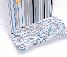 Places with similar names to Atū, Iran ::
Disclaimer :: Information on this page comes without warranty of any kind |
||
|
Where is Atū? Elevation and coordinates ::
Latitude (lat): 36°14'10"N Longitude (lon): 53°0'32"E
Elevation (approx.): 726m (map arrows pan, magnifying glasses zoom) |
||
|
Visiting Atū? Hotel/Accommodation ::
Book a hotel in Atū Travel Guide ::
Buy a travel guide for Iran rental cars ::
car rental offers GPS waypoint ::
download a GPX waypoint (PoI) of Atū for your GPS receiver
|
||