|
search place name
|
||
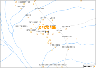
‘Azīzābād (Khorāsān, Iran)‘Azīzābād is a town in the Khorāsān region of Iran. An overview map of the region around ‘Azīzābād is displayed below.
regional and 3d topo map of ‘Azīzābād, Iran ::
Nearby towns ::
Jannatābād (0.0km west) //
Ḩoseynābād (1.3km south) //
Allāhābād (1.5km south) //
Sheykhābād (1.5km west) //
Chow Rīz (1.5km east) //
Chowrīz (1.5km east) //
Dasht-e Qarān (2.5km south) //
Dasht-e Qarān (2.5km south) //
Dowlatābād (2.7km north) //
Hādīābād (2.4km west) //
Ḩojjatābād (2.9km south) //
Qodratābād (3.7km south) //
Sa‘ādatābād (3.7km south) //
Shīrābād (3.4km west) //
Hemmatābād (3.6km north west) //
Raḩmatābād (3.6km north west) //
Solţān Ḩoseyn Reẕā (4.0km north west) //
Ţabas (3.7km east) //
Moḩammadābād (4.7km north west) //
‘Alīābād (5.3km north west) //
Jamz (5.6km north) //
Jogār (5.8km north) //
Fīrūzābād (5.7km south east) //
Ḩasanābād (5.5km west) //
Deh Now-e Fāţemeh Barāt (6.6km south) //
Fatḩābād (5.9km north west) //
Naqīābād (5.9km west) //
Sar Āsīāb (6.2km east) //
Deyheshak (6.5km east) //
[all distances 'as the bird flies' and approximate]  Places with similar names to ‘Azīzābād, Iran ::
Disclaimer :: Information on this page comes without warranty of any kind |
||
|
Where is ‘Azīzābād? Elevation and coordinates ::
Latitude (lat): 33°35'0"N Longitude (lon): 56°53'0"E
Elevation (approx.): 644m (map arrows pan, magnifying glasses zoom) |
||
|
Visiting ‘Azīzābād? Hotel/Accommodation ::
Book a hotel in ‘Azīzābād Travel Guide ::
Buy a travel guide for Iran rental cars ::
car rental offers GPS waypoint ::
download a GPX waypoint (PoI) of ‘Azīzābād for your GPS receiver
|
||