|
search place name
|
||
Bābā Aḩmadī (Chahār Maḩāll va Bakhtīār, Iran)Bābā Aḩmadī is a town in the Chahār Maḩāll va Bakhtīār region of Iran. An overview map of the region around Bābā Aḩmadī is displayed below.
regional and 3d topo map of Bābā Aḩmadī, Iran ::

Bābā Aḩmadī airports ::
The nearest airport is QMJ - Masjed Soleiman Shahid Asyaee, located 202.7 km north west of Bābā Aḩmadī.
Other airports nearby include SYZ - Shiraz Shahid Dastghaib Intl (235.0 km south east), Nearby towns ::
Mīāntalān (1.7km west) //
Amīrān-e Bālā (2.2km north) //
Kalvārī-e Bālā (2.3km south west) //
Kalvārī-ye Pā'īn (2.3km south west) //
Amīrān-e Pā'īn (2.4km north west) //
Kondar (2.4km north west) //
Kolvārī (2.7km south) //
Māl-e Khalīfeh (2.7km south east) //
Māl-e Khalīfeh (2.7km south east) //
Mīshān-e Pā'īn (2.8km south west) //
Khong (3.5km south) //
Abū Esḩāq (3.1km north east) //
Mīshān-e Bālā (3.0km west) //
Deh Sūkhteh (3.8km south west) //
Shahrīār (4.6km north west) //
Vanakī (5.3km south) //
Mīnāb (5.1km west) //
Dasht-e Pāgerd (6.0km south) //
Chahār Deh (6.1km north west) //
Deh-e Golābī (5.9km west) //
Sandegān-e Bālā (7.0km south east) //
Sandegān-e Pā'īn (7.0km south east) //
Sahlābād (6.6km south west) //
Qaraḩ (8.0km south) //
Ganj (7.9km north west) //
Deh Chenār-e Dālvarād (7.6km west) //
Rostam Begī (8.8km south) //
Gerdāb (8.9km south) //
Bīzh Gerd (8.8km south west) //
[all distances 'as the bird flies' and approximate] 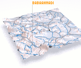 Places with similar names to Bābā Aḩmadī, Iran ::
// Bābā Aḩmad (IR)
// Bābā Aḩmad (IR)
// Bābā Aḩmad (IR)
// Bābā Aḩmad (IR)
// Bobometo (TP)
// Babamatoa (ID)
Disclaimer :: Information on this page comes without warranty of any kind |
||
|
Where is Bābā Aḩmadī? Elevation and coordinates ::
Latitude (lat): 31°18'48"N Longitude (lon): 51°15'0"E
Elevation (approx.): 1871m (map arrows pan, magnifying glasses zoom) |
||
|
Visiting Bābā Aḩmadī? Hotel/Accommodation ::
Book a hotel in Bābā Aḩmadī Travel Guide ::
Buy a travel guide for Iran rental cars ::
car rental offers GPS waypoint ::
download a GPX waypoint (PoI) of Bābā Aḩmadī for your GPS receiver
|
||