|
search place name
|
||
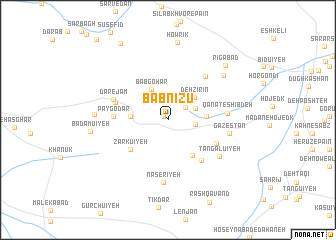
Bābnīzū (Kermān, Iran)Bābnīzū is a town in the Kermān region of Iran. An overview map of the region around Bābnīzū is displayed below.
regional and 3d topo map of Bābnīzū, Iran ::
Bābnīzū airports ::
The nearest airport is KER - Kerman, located 54.5 km south of Bābnīzū.
Nearby towns ::
Ma‘dan-e Bābnīzū (0.6km north west) //
Balūchīyeh (2.2km north east) //
Dastgerd (2.7km east) //
Konū'īyeh (2.9km north east) //
Deh Zīrīn (3.5km north east) //
Bābgohar (3.8km north west) //
Bīdābād (3.6km west) //
Gosāvīyeh (3.7km east) //
Bābsefīd (4.6km south east) //
Zārkū'īyeh (4.9km south west) //
Māhzamīn (5.6km south east) //
Pāy Godār (5.2km west) //
Chenārū'īyeh (5.4km south east) //
Dar-e Ādamī (5.4km west) //
Shāhzādeh Moḩammad (6.1km north east) //
Dar-e Jam (5.7km north west) //
Qanāt-e Shībdeh (5.7km east) //
Tangalū'īyeh (6.4km south east) //
Nāşerīyeh (7.0km south) //
Gazestān (6.1km east) //
Garīk (7.3km north east) //
Bīd-e Khūnī (7.1km west) //
Bādāmū'īyeh (7.5km west) //
Howrīk (8.7km north) //
Rīgābād (8.2km north east) //
Amredū'īyeh (9.7km north west) //
[all distances 'as the bird flies' and approximate]  Places with similar names to Bābnīzū, Iran ::
Disclaimer :: Information on this page comes without warranty of any kind |
||
|
Where is Bābnīzū? Elevation and coordinates ::
Latitude (lat): 30°45'47"N Longitude (lon): 56°53'16"E
Elevation (approx.): 2424m (map arrows pan, magnifying glasses zoom) |
||
|
Visiting Bābnīzū? Hotel/Accommodation ::
Book a hotel in Bābnīzū Travel Guide ::
Buy a travel guide for Iran rental cars ::
car rental offers GPS waypoint ::
download a GPX waypoint (PoI) of Bābnīzū for your GPS receiver
|
||