|
search place name
|
||
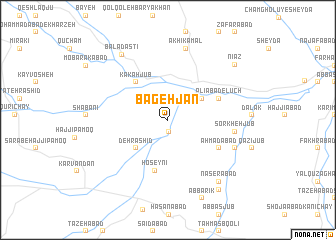
Bageh Jān (Kordestān, Iran)Bageh Jān is a town in the Kordestān region of Iran. An overview map of the region around Bageh Jān is displayed below.
regional and 3d topo map of Bageh Jān, Iran ::
Bageh Jān airports ::
The nearest airport is SDG - Sanandaj, located 42.0 km west of Bageh Jān.
Other airports nearby include KSH - Bakhtaran Shahid Ashrafi Esfahani (115.8 km south), Nearby towns ::
Telvār (1.3km south) //
Tāzehābād-e Gāvmīshān (3.9km north east) //
Dehrashīd (4.3km south west) //
Kākah Jūb (5.1km north west) //
Ḩoseynī (5.8km south) //
‘Alīābād-e Lūch (5.2km north east) //
Aḩmadābād (5.6km south east) //
Sorkheh Jūb (6.3km east) //
Āsīāb Jūb (6.9km south east) //
Ākhī Kamāl (8.1km north) //
Naşerābād (8.3km south east) //
Baladastī (8.4km north west) //
Āb Bārīk (9.3km south) //
Ārazand (9.1km south east) //
Nīāz (8.7km north east) //
[all distances 'as the bird flies' and approximate]  Places with similar names to Bageh Jān, Iran ::
Disclaimer :: Information on this page comes without warranty of any kind |
||
|
Where is Bageh Jān? Elevation and coordinates ::
Latitude (lat): 35°21'43"N Longitude (lon): 47°26'56"E
Elevation (approx.): 1769m (map arrows pan, magnifying glasses zoom) |
||
|
Visiting Bageh Jān? Hotel/Accommodation ::
Book a hotel in Bageh Jān Travel Guide ::
Buy a travel guide for Iran rental cars ::
car rental offers GPS waypoint ::
download a GPX waypoint (PoI) of Bageh Jān for your GPS receiver
|
||