|
search place name
|
||
Bāgh-e Hanti (Iran)Bāgh-e Hanti is a town in Iran. An overview map of the region around Bāgh-e Hanti is displayed below.
regional and 3d topo map of Bāgh-e Hanti, Iran ::

Bāgh-e Hanti airports ::
The nearest airport is KER - Kerman, located 120.4 km north of Bāgh-e Hanti.
Other airports nearby include BND - Bandar Abbass Intl (236.8 km south), Nearby towns ::
Khārdān (1.6km north west) //
Deh Gerdū (2.3km north east) //
Sar Godār (2.5km north east) //
Godār (2.6km north east) //
Dāmaneh (3.5km north) //
Dubār (3.2km west) //
Rūkīn (3.6km north west) //
Deh Konārī (3.7km north west) //
Fatḩābād (4.0km north east) //
Āb Garm (4.0km north east) //
Kahn Bīd Sar (3.8km north east) //
Baghalū'īyeh (4.3km east) //
Khvoshāb (4.5km west) //
Seh Cheshmeh (5.1km north) //
Kahnūj (5.4km north) //
Khāk-e Sefīd (5.2km north west) //
Orkotī (4.9km east) //
Esfārch (5.4km north west) //
Mowrū'īyeh (5.2km west) //
Deh Kahīrī (5.2km west) //
Qanāt-e Zangal (5.2km east) //
Kahnūj-e Shāhrokhī (5.2km east) //
Darāsīa (5.2km east) //
Deh Dīvān (5.4km east) //
Qanāt-e Aḩmad (6.1km north east) //
Khāfkū'īyeh (6.0km east) //
Gerdū Kalān (7.0km south) //
Khaz̄nekān (7.4km south) //
Gerdū Chūb (6.7km east) //
[all distances 'as the bird flies' and approximate] 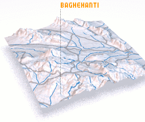 Places with similar names to Bāgh-e Hanti, Iran :: Disclaimer :: Information on this page comes without warranty of any kind |
||
|
Where is Bāgh-e Hanti? Elevation and coordinates ::
Latitude (lat): 29°13'0"N Longitude (lon): 57°14'0"E
Elevation (approx.): 2862m (map arrows pan, magnifying glasses zoom) |
||
|
Visiting Bāgh-e Hanti? Hotel/Accommodation ::
Book a hotel in Bāgh-e Hanti Travel Guide ::
Buy a travel guide for Iran rental cars ::
car rental offers GPS waypoint ::
download a GPX waypoint (PoI) of Bāgh-e Hanti for your GPS receiver
|
||