|
search place name
|
||
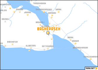
Bāgh-e Paseh (Ostān-e Būshehr, Iran)Bāgh-e Paseh is a town in the Ostān-e Būshehr region of Iran. An overview map of the region around Bāgh-e Paseh is displayed below.
regional and 3d topo map of Bāgh-e Paseh, Iran ::
Bāgh-e Paseh airports ::
The nearest airport is BUZ - Bushehr, located 160.4 km north west of Bāgh-e Paseh.
Other airports nearby include SYZ - Shiraz Shahid Dastghaib Intl (193.5 km north), BAH - Bahrain Intl (221.7 km south west), DHA - Dhahran King Abdulaziz Ab (253.2 km south west), Nearby towns ::
Bardestān (1.7km south east) //
Lombadān-e Khātamī (2.1km north east) //
Bāgh-e Nāşer (2.3km north west) //
Tal-e Re'īs (2.7km north west) //
Lombadān-e Pā'īn (3.1km north) //
Nowkan (3.7km north east) //
Band-e Rāshed (4.4km north) //
Lombadān Bālā'ī (4.4km north east) //
Seyyed Şafā (5.2km south) //
Bāgh-e ‘Ālī (5.0km north west) //
Bandar-e Deyyer (5.7km south) //
Ganabī (6.8km north) //
Dorāhak (7.6km north) //
Banak (7.5km east) //
Ūlī Bozorg (7.9km south west) //
Eḩshām-e Gankhīkī (9.1km north) //
Darak (9.4km north) //
Ūlī Kuchak (8.9km south west) //
Jamrak (10.6km north west) //
[all distances 'as the bird flies' and approximate] 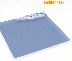 Places with similar names to Bāgh-e Paseh, Iran :: Disclaimer :: Information on this page comes without warranty of any kind |
||
|
Where is Bāgh-e Paseh? Elevation and coordinates ::
Latitude (lat): 27°53'12"N Longitude (lon): 51°57'4"E
Elevation (approx.): 9m (map arrows pan, magnifying glasses zoom) |
||
|
Visiting Bāgh-e Paseh? Hotel/Accommodation ::
Book a hotel in Bāgh-e Paseh Travel Guide ::
Buy a travel guide for Iran rental cars ::
car rental offers GPS waypoint ::
download a GPX waypoint (PoI) of Bāgh-e Paseh for your GPS receiver
|
||