|
search place name
|
||
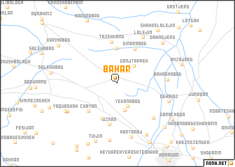
Bahār (Hamadān, Iran)Bahār is a town in the Hamadān region of Iran. An overview map of the region around Bahār is displayed below.
regional and 3d topo map of Bahār, Iran ::
Bahār airports ::
The nearest airport is KSH - Bakhtaran Shahid Ashrafi Esfahani, located 133.1 km south west of Bahār.
Other airports nearby include SDG - Sanandaj (135.9 km west), Nearby towns ::
Ganj Tappeh (3.5km north east) //
Yekanābād (4.0km south) //
Mahdīābād (4.4km south) //
Ḩesāmābād (5.5km north) //
Dīnārābād (6.0km north east) //
Cheshmeh Qaşşābān (6.1km south) //
Chāyān (5.9km south west) //
Tāzeh Kand (6.7km north) //
Ūznān (6.7km south) //
Anşār ol Emām (7.3km south east) //
Bahrāmābād (6.6km east) //
Lālejīn (8.0km north east) //
Deh Pīāz (7.4km south east) //
Maryānaj (8.8km south) //
Ḩoseynābād-e Bahār (8.0km south west) //
Dīzaj (9.1km south east) //
Ya‘qūb Shāh (8.2km south west) //
Dahnejerd (8.8km north east) //
‘Alīābād-e Posht-e Shahr (9.4km south east) //
Garā Choqā (9.2km south east) //
Shahr-e Lālejīn (10.0km north east) //
[all distances 'as the bird flies' and approximate] 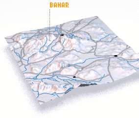 Places with similar names to Bahār, Iran ::
Disclaimer :: Information on this page comes without warranty of any kind |
||
|
Where is Bahār? Elevation and coordinates ::
Latitude (lat): 34°54'26"N Longitude (lon): 48°26'29"E
Elevation (approx.): 1722m (map arrows pan, magnifying glasses zoom) |
||
|
Visiting Bahār? Hotel/Accommodation ::
Book a hotel in Bahār Travel Guide ::
Buy a travel guide for Iran rental cars ::
car rental offers GPS waypoint ::
download a GPX waypoint (PoI) of Bahār for your GPS receiver
|
||