|
search place name
|
||
Bājānī (Hormozgān, Iran)Bājānī is a town in the Hormozgān region of Iran. An overview map of the region around Bājānī is displayed below.
regional and 3d topo map of Bājānī, Iran ::

Bājānī airports ::
The nearest airport is BND - Bandar Abbass Intl, located 101.2 km south west of Bājānī.
Other airports nearby include KHS - Khasab (196.3 km south west), Nearby towns ::
Kahūrān Garān (1.6km south) //
Zamīnān (1.8km north) //
Khodrowgan (2.7km north) //
Gowdbajag (2.5km north east) //
Bīdān (2.9km north) //
Sar Kūh (2.7km east) //
Qalamān-e Gūrān (3.0km east) //
Band-e Nowrūz (3.3km north) //
Sūparīān (3.6km south) //
Mīrābī (3.8km north west) //
Doholyān (4.1km north west) //
Rahbarān (4.2km north) //
Nīm Kār (4.6km north) //
Hormoz (4.6km north) //
Dūlāb Ḩasan (4.8km north) //
Bīdān (4.8km south) //
Sarzeh-ye Pā'īn (5.0km north) //
Monjar (5.1km north west) //
Chakarī (5.1km north west) //
Nakhl-e Dokhtarān (5.4km north west) //
Gaz Āzār (5.7km south) //
Pīrū'īyeh (5.8km north) //
Bahādorak (5.9km north) //
Dāzbaz (6.1km south) //
Posht Kam (6.5km south) //
Āb Tārīkān (6.1km north west) //
Zīārat-e ‘Alī (6.4km north west) //
Chīromābād (6.7km north) //
Sīāh Moghān-e Pā'īn (6.3km south west) //
[all distances 'as the bird flies' and approximate] 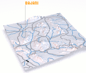 Places with similar names to Bājānī, Iran ::
Disclaimer :: Information on this page comes without warranty of any kind |
||
|
Where is Bājānī? Elevation and coordinates ::
Latitude (lat): 27°41'36"N Longitude (lon): 57°15'8"E
Elevation (approx.): 530m (map arrows pan, magnifying glasses zoom) |
||
|
Visiting Bājānī? Hotel/Accommodation ::
Book a hotel in Bājānī Travel Guide ::
Buy a travel guide for Iran rental cars ::
car rental offers GPS waypoint ::
download a GPX waypoint (PoI) of Bājānī for your GPS receiver
|
||