|
search place name
|
||
Bālā Başrā (Iran)Bālā Başrā is a town in Iran. An overview map of the region around Bālā Başrā is displayed below.
regional and 3d topo map of Bālā Başrā, Iran ::

Nearby towns ::
Lāk Tarāsh (0.9km east) //
Ramadān Kheyl (1.5km south west) //
Shīrkolā (1.8km south east) //
Gelvard-e Kūchek (2.6km north) //
Gorg Taj (2.1km west) //
Kār Kam (3.7km north) //
Gelvard-e Bozorg (4.0km north) //
Lā'ī-ye Pāsand (3.9km south east) //
Rūdbār Yakhkesh (5.0km north east) //
Moḩammadābād (5.6km north) //
Moḩammadābād (5.8km north) //
Kafkūr (4.8km south east) //
Chālek Deh (4.8km north east) //
Band-e Benī (5.2km south west) //
Shīrdārī (5.8km north east) //
Valam (6.3km north east) //
Lalard (5.8km north west) //
Khorram Chammāz (6.2km west) //
Kabkūr (6.2km east) //
Ya‘qūb Maḩalleh (6.4km west) //
Zīārat Kolā (6.9km south east) //
Azrak (6.6km south east) //
Kolā Rūd Bār (7.9km south) //
Mollā Kheyl (7.0km south east) //
Kenet (7.0km north west) //
Lā'ī Rūdbār (7.9km south east) //
Gharīb Maḩalleh (7.2km east) //
Shīt (8.6km south west) //
Lā'ī (8.1km south east) //
[all distances 'as the bird flies' and approximate] 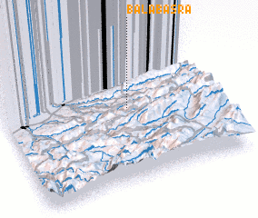 Places with similar names to Bālā Başrā, Iran ::
Disclaimer :: Information on this page comes without warranty of any kind |
||
|
Where is Bālā Başrā? Elevation and coordinates ::
Latitude (lat): 36°33'0"N Longitude (lon): 53°36'0"E
Elevation (approx.): 575m (map arrows pan, magnifying glasses zoom) |
||
|
Visiting Bālā Başrā? Hotel/Accommodation ::
Book a hotel in Bālā Başrā Travel Guide ::
Buy a travel guide for Iran rental cars ::
car rental offers GPS waypoint ::
download a GPX waypoint (PoI) of Bālā Başrā for your GPS receiver
|
||