|
search place name
|
||
Bānqārān (Ostān-e Āz̄arbāyjān-e Sharqī, Iran)Bānqārān is a town in the Ostān-e Āz̄arbāyjān-e Sharqī region of Iran. An overview map of the region around Bānqārān is displayed below.
regional and 3d topo map of Bānqārān, Iran ::

Bānqārān airports ::
The nearest airport is TBZ - Tabriz Intl, located 119.6 km north west of Bānqārān.
Nearby towns ::
Bāyazīd (2.4km north east) //
Khvājeh Maḩmūd (2.4km north west) //
Tāzeh Kand (2.9km east) //
Makatū (4.8km south west) //
Zāvīyeh (5.2km south) //
Āq Dāgh (4.4km east) //
Ḩoseyn Ālān (4.4km east) //
Dalmeh (5.8km north) //
‘Arablū (5.8km north) //
Dīnī Jūq (4.8km south east) //
Īstgāh-e Khorāsānak (5.8km north west) //
Darreh Yānūq (6.3km north east) //
Ūryā Chūq (6.3km south east) //
Dodeh (7.4km north) //
Aḩmadābād (7.6km south) //
Khorāsānlū (7.0km north west) //
Qarājeh Qayah-ye Khorāsānlū (7.0km north west) //
Āleqū (8.1km south west) //
Ḩasan Kandī Rūd (9.5km north east) //
Afshār Jīq (9.5km north east) //
[all distances 'as the bird flies' and approximate] 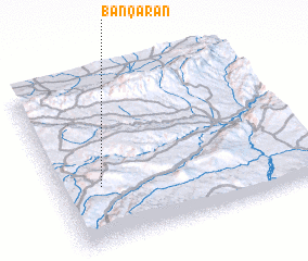 Places with similar names to Bānqārān, Iran ::
// Ban Karon (TH)
// Ban Karon (TH)
// Ban Karon Noi (TH)
// Ban Karon Noi (TH)
// Ban Khron (TH)
// Ban Ko Rian (TH)
// Ban Ko Rian (TH)
// Ban Krai Nai (TH)
// Ban Kroen (TH)
// Ban Kron (TH)
Disclaimer :: Information on this page comes without warranty of any kind |
||
|
Where is Bānqārān? Elevation and coordinates ::
Latitude (lat): 37°21'0"N Longitude (lon): 47°10'0"E
Elevation (approx.): 1722m (map arrows pan, magnifying glasses zoom) |
||
|
Visiting Bānqārān? Hotel/Accommodation ::
Book a hotel in Bānqārān Travel Guide ::
Buy a travel guide for Iran rental cars ::
car rental offers GPS waypoint ::
download a GPX waypoint (PoI) of Bānqārān for your GPS receiver
|
||