|
search place name
|
||
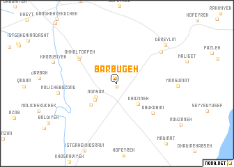
Barbūgeh (Khūzestān, Iran)Barbūgeh is a town in the Khūzestān region of Iran. An overview map of the region around Barbūgeh is displayed below.
regional and 3d topo map of Barbūgeh, Iran ::
Barbūgeh airports ::
The nearest airport is AWZ - Ahwaz, located 21.8 km north west of Barbūgeh.
Other airports nearby include MRX - Bandar Mahshahr Mahshahr (72.6 km south), QMJ - Masjed Soleiman Shahid Asyaee (100.3 km north), ABD - Abadan (107.4 km south west), BSR - Basrah Intl (134.3 km south west), Nearby towns ::
Beg‘ān (0.5km south) //
Man Sar (3.6km south west) //
Tambūdorūsheyd (4.0km south west) //
Khazīneh (4.4km south east) //
Manīzh (5.0km south west) //
Emāmzādeh Seyyed Şāleḩ (6.5km north west) //
Moţrafeh (6.5km north west) //
Omm ol Ţorfeh (6.6km north west) //
Abu Kabīrī (6.8km south east) //
Mashraḩāt (7.9km north east) //
Dereylīn (9.1km north east) //
[all distances 'as the bird flies' and approximate]  Places with similar names to Barbūgeh, Iran ::
// Baire Abajo (CU)
// Barrio Bajo (ES)
// Barrio Bajo (ES)
// Bar-e Bījeh (IR)
// Bāra Bāgi (BD)
// Berābājua (BD)
// Barrio Abajo (SV)
// Barbegi (PK)
// Barbaji (NG)
// Burbidge (AU)
Disclaimer :: Information on this page comes without warranty of any kind |
||
|
Where is Barbūgeh? Elevation and coordinates ::
Latitude (lat): 31°9'52"N Longitude (lon): 48°52'17"E
Elevation (approx.): 12m (map arrows pan, magnifying glasses zoom) |
||
|
Visiting Barbūgeh? Hotel/Accommodation ::
Book a hotel in Barbūgeh Travel Guide ::
Buy a travel guide for Iran rental cars ::
car rental offers GPS waypoint ::
download a GPX waypoint (PoI) of Barbūgeh for your GPS receiver
|
||