|
search place name
|
||
Barcham (Kordestān, Iran)Barcham is a town in the Kordestān region of Iran. An overview map of the region around Barcham is displayed below.
regional and 3d topo map of Barcham, Iran ::

Barcham airports ::
The nearest airport is SDG - Sanandaj, located 122.8 km south of Barcham.
Other airports nearby include TBZ - Tabriz Intl (205.3 km north), KSH - Bakhtaran Shahid Ashrafi Esfahani (223.2 km south), Nearby towns ::
Akhẕarābād (2.4km north east) //
Raḩīmābād (3.5km north east) //
Yūrqol (3.5km south east) //
Chūmolū (3.5km north west) //
Qareh Nāv (4.0km south) //
Gol Tappeh (5.6km north) //
‘Abbās Raqeh (5.8km north) //
Abū ol Ma‘man (5.8km south east) //
Qeţānjoq (5.8km south west) //
Ţūmār Qamīsh (6.3km north west) //
Tīkānlū (7.6km south) //
Dālū (7.1km south west) //
Ḩājjī Ḩasan (7.1km north east) //
Zīvīyeh (7.4km south east) //
Kord Kand (8.2km south east) //
Chāgherlū (8.2km south west) //
Khvosh Qeshlāq (10.2km north east) //
[all distances 'as the bird flies' and approximate] 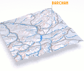 Places with similar names to Barcham, Iran ::
// Brea Chem (US)
// Berchum (DE)
// Berresheim (DE)
// Berresheim (DE)
// Bruchheim (DE)
// Birchim (US)
// Berchem (LU)
// Barāshīm (EG)
// Brŭchma (BG)
// Barchim (RU)
Disclaimer :: Information on this page comes without warranty of any kind |
||
|
Where is Barcham? Elevation and coordinates ::
Latitude (lat): 36°19'0"N Longitude (lon): 46°40'0"E
Elevation (approx.): 1744m (map arrows pan, magnifying glasses zoom) |
||
|
Visiting Barcham? Hotel/Accommodation ::
Book a hotel in Barcham Travel Guide ::
Buy a travel guide for Iran rental cars ::
car rental offers GPS waypoint ::
download a GPX waypoint (PoI) of Barcham for your GPS receiver
|
||