|
search place name
|
||
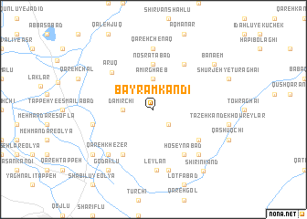
Bāyrām Kandī (Ostān-e Āz̄arbāyjān-e Sharqī, Iran)Bāyrām Kandī is a town in the Ostān-e Āz̄arbāyjān-e Sharqī region of Iran. An overview map of the region around Bāyrām Kandī is displayed below.
regional and 3d topo map of Bāyrām Kandī, Iran ::
Bāyrām Kandī airports ::
The nearest airport is TBZ - Tabriz Intl, located 116.6 km north of Bāyrām Kandī.
Other airports nearby include SDG - Sanandaj (216.0 km south), Nearby towns ::
‘Abdolābād (2.4km south east) //
Damīrchī (3.0km west) //
Amīr Ghā'eb (3.7km north) //
Qorbān Kandī (3.7km north) //
Noşratābād (5.6km north) //
Ḩoseynābād (6.3km south east) //
Dāsh Bolāgh (6.3km north east) //
Choghānlū (5.8km south east) //
Qandhār (6.3km south west) //
Ārūq (6.0km north west) //
Qareh Chenāq (7.4km north) //
Leylān (7.4km south) //
Ḩasanābād (7.6km south) //
Ḩoseynābād (6.2km west) //
Qareh Kheẕer (7.1km south west) //
Cheghālū (7.1km south east) //
Godaklū (8.6km south west) //
Banā'em (8.1km north east) //
Mamahdel (8.1km south west) //
Āqkand-e Qareh Kheẕer (8.1km south west) //
Shīrīn Kand (9.0km south east) //
[all distances 'as the bird flies' and approximate] 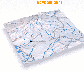 Places with similar names to Bāyrām Kandī, Iran ::
// Bahrām Kandī (IR)
// Bāyrām Kandī (IR)
// Bāyrām Kandī (IR)
// Bāyrām Kandī (IR)
// Birāmkāndi (BD)
// Biéré Am Kindoué (TD)
// Brahma Kund (IN)
// Brahmakund (IN)
// Bourèm Guindou (ML)
Disclaimer :: Information on this page comes without warranty of any kind |
||
|
Where is Bāyrām Kandī? Elevation and coordinates ::
Latitude (lat): 37°5'0"N Longitude (lon): 46°13'0"E
Elevation (approx.): 1400m (map arrows pan, magnifying glasses zoom) |
||
|
Visiting Bāyrām Kandī? Hotel/Accommodation ::
Book a hotel in Bāyrām Kandī Travel Guide ::
Buy a travel guide for Iran rental cars ::
car rental offers GPS waypoint ::
download a GPX waypoint (PoI) of Bāyrām Kandī for your GPS receiver
|
||