|
search place name
|
||
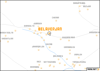
Belāverjān (Markaz, Iran)Belāverjān is a town in the Markaz region of Iran. An overview map of the region around Belāverjān is displayed below.
regional and 3d topo map of Belāverjān, Iran ::
Belāverjān airports ::
The nearest airport is QMJ - Masjed Soleiman Shahid Asyaee, located 216.2 km south of Belāverjān.
Other airports nearby include THR - Teheran Mehrabad Intl (234.9 km north east), Nearby towns ::
Robāţ-e Āghāj (1.2km west) //
Sar Kūbeh (2.6km south west) //
Chowgān (2.8km west) //
Māhūrzān (3.2km west) //
Khowgān (3.6km south east) //
Khīz Āb (4.4km south) //
Pandar Jān (3.9km west) //
Jūbādeh (5.0km north west) //
Zanjīrak (5.0km west) //
Sīān-e Soflá (5.1km west) //
Chenār (6.0km north) //
Jahān Qal‘eh (6.5km south west) //
Khūgān-e Pāʼīn (6.2km east) //
Sīān-e ‘Olyā (6.8km west) //
Karabādeh (8.3km south east) //
Khvorāvand (9.1km south east) //
Qolteh (10.3km south east) //
[all distances 'as the bird flies' and approximate]  Places with similar names to Belāverjān, Iran :: Disclaimer :: Information on this page comes without warranty of any kind |
||
|
Where is Belāverjān? Elevation and coordinates ::
Latitude (lat): 33°49'0"N Longitude (lon): 50°7'0"E
Elevation (approx.): 1914m (map arrows pan, magnifying glasses zoom) |
||
|
Visiting Belāverjān? Hotel/Accommodation ::
Book a hotel in Belāverjān Travel Guide ::
Buy a travel guide for Iran rental cars ::
car rental offers GPS waypoint ::
download a GPX waypoint (PoI) of Belāverjān for your GPS receiver
|
||