|
search place name
|
||
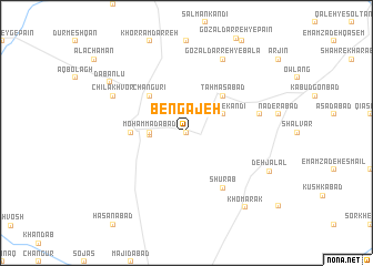
Bengajeh (Iran)Bengajeh is a town in Iran. An overview map of the region around Bengajeh is displayed below.
regional and 3d topo map of Bengajeh, Iran ::
Bengajeh airports ::
The nearest airport is RAS - Rasht, located 138.7 km north east of Bengajeh.
Other airports nearby include SDG - Sanandaj (191.2 km south west), Nearby towns ::
Yengejeh (0.0km north) //
Būlāmājī (2.9km west) //
Moḩammadābād (3.0km west) //
Shāh Bekandī (3.5km north east) //
Changūrī (4.8km north west) //
Ţahmāsābād (4.8km north east) //
Balā Māchī (4.5km west) //
Shūrāb (6.3km south east) //
Chap Darreh (6.3km east) //
Chīlākhvor (7.0km north west) //
Gozal Darreh-ye Bālā (8.0km north) //
Dābānlū (8.0km north west) //
Deh Jalāl (7.8km south east) //
Khomārak (8.9km south east) //
[all distances 'as the bird flies' and approximate] 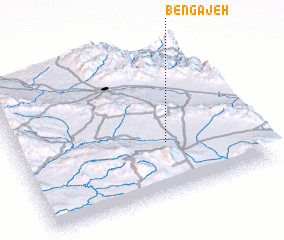 Places with similar names to Bengajeh, Iran ::
// Bāniākāji (BD)
// Bānkāij (BD)
// Bunakijja (UG)
// Ban Kogiou (LA)
// (( Bungaj )) (AL)
// Bongoja (LR)
// Bản Ké Giào (VN)
// Banqiaoji (CN)
// Banqiaoji (CN)
// Bingji (CN)
Disclaimer :: Information on this page comes without warranty of any kind |
||
|
Where is Bengajeh? Elevation and coordinates ::
Latitude (lat): 36°21'0"N Longitude (lon): 48°38'0"E
Elevation (approx.): 2001m (map arrows pan, magnifying glasses zoom) |
||
|
Visiting Bengajeh? Hotel/Accommodation ::
Book a hotel in Bengajeh Travel Guide ::
Buy a travel guide for Iran rental cars ::
car rental offers GPS waypoint ::
download a GPX waypoint (PoI) of Bengajeh for your GPS receiver
|
||