|
search place name
|
||
Bon Pahneh (Lorestān, Iran)Bon Pahneh is a town in the Lorestān region of Iran. An overview map of the region around Bon Pahneh is displayed below.
regional and 3d topo map of Bon Pahneh, Iran ::

Bon Pahneh airports ::
The nearest airport is KSH - Bakhtaran Shahid Ashrafi Esfahani, located 123.0 km north west of Bon Pahneh.
Other airports nearby include QMJ - Masjed Soleiman Shahid Asyaee (203.7 km south east), SDG - Sanandaj (218.3 km north), Nearby towns ::
Sīāh Manşūr (0.0km north) //
Hapelāneh (2.4km south east) //
Heygeh-e Kālīāb (4.0km north west) //
Ţīār-e Amīrān (3.6km south west) //
Mūrd-e Mūmen (4.0km north east) //
Dorūghzan Āb (3.6km north east) //
Zarrīn Bon (3.6km south east) //
Gāv Zardūl (4.0km south east) //
Darreh Derāz (4.3km north east) //
As̄ar Zamīn-e Kālīāb (5.6km north) //
Cham-eQalandar (4.7km east) //
Bāgh Pīrūz-e Heygah (5.8km north) //
Movelah (5.8km north) //
Heygeh-e Ebrāhīm (6.4km north west) //
Kūr Shūrāb-e ‘Alīshāh (6.4km north west) //
Chahār Qal‘eh-ye Bārānī (5.9km south west) //
Cham-e Ḩeydar (6.0km east) //
Cham Māhīlān (6.2km east) //
Bontūmān-e Seh (6.2km east) //
Qālebī-ye Soflá (6.8km north east) //
Dūl Gāv-e ‘Alī Ḩoseyn (7.6km north) //
Bontūmān-e Do (6.5km east) //
Cham-e Qahremān (6.5km east) //
Ḩayāt ol Gheyb (7.7km north east) //
Do Āb-e Kūr Shūrāb (8.0km north west) //
Moḩammad Chenār (8.3km north) //
Ḩoseyn Jān (7.4km east) //
Qālebī-ye ‘Olyā (8.3km north east) //
Khārzār (8.6km north east) //
[all distances 'as the bird flies' and approximate] 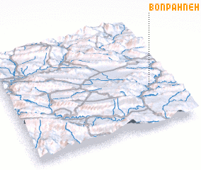 Places with similar names to Bon Pahneh, Iran ::
// Binapon (PH)
// Ban Na Pan (TH)
// Ban Na Pan (TH)
// Ban Na Po Nua (TH)
// Ban Na Pun (TH)
// Ban Na Pun (TH)
// Ban Paen (TH)
// Ban Paen (TH)
// Ban Paen (TH)
// Ban Pan (TH)
Disclaimer :: Information on this page comes without warranty of any kind |
||
|
Where is Bon Pahneh? Elevation and coordinates ::
Latitude (lat): 33°25'0"N Longitude (lon): 47°53'0"E
Elevation (approx.): 1382m (map arrows pan, magnifying glasses zoom) |
||
|
Visiting Bon Pahneh? Hotel/Accommodation ::
Book a hotel in Bon Pahneh Travel Guide ::
Buy a travel guide for Iran rental cars ::
car rental offers GPS waypoint ::
download a GPX waypoint (PoI) of Bon Pahneh for your GPS receiver
|
||