|
search place name
|
||
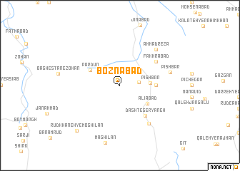
Boznābād (Khorāsān, Iran)Boznābād is a town in the Khorāsān region of Iran. An overview map of the region around Boznābād is displayed below.
regional and 3d topo map of Boznābād, Iran ::
Boznābād airports ::
The nearest airport is XBJ - Birjand, located 82.2 km south west of Boznābād.
Nearby towns ::
Baqāl (2.5km east) //
Pīsh Bar (4.0km east) //
‘Alīābād (4.6km south east) //
Par dūn (4.6km north west) //
Kalāteh-ye Kenāyat (4.7km east) //
Dasht-e Geryāneh (5.8km south east) //
Fakhrābād (6.0km north east) //
Khowshābād (7.1km south east) //
Aḩmad Reẕā (7.3km north east) //
Pīsh Bar (6.9km east) //
Rūdkhāneh-ye Moghīlān (9.0km south west) //
[all distances 'as the bird flies' and approximate] 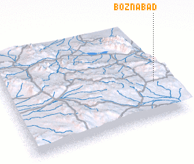
Disclaimer :: Information on this page comes without warranty of any kind |
||
|
Where is Boznābād? Elevation and coordinates ::
Latitude (lat): 33°22'59"N Longitude (lon): 59°55'58"E
Elevation (approx.): 2092m (map arrows pan, magnifying glasses zoom) |
||
|
Visiting Boznābād? Hotel/Accommodation ::
Book a hotel in Boznābād Travel Guide ::
Buy a travel guide for Iran rental cars ::
car rental offers GPS waypoint ::
download a GPX waypoint (PoI) of Boznābād for your GPS receiver
|
||