|
search place name
|
||
Chāh Bor (Lorestān, Iran)Chāh Bor is a town in the Lorestān region of Iran. An overview map of the region around Chāh Bor is displayed below.
regional and 3d topo map of Chāh Bor, Iran ::

Chāh Bor airports ::
The nearest airport is QMJ - Masjed Soleiman Shahid Asyaee, located 193.0 km south of Chāh Bor.
Other airports nearby include THR - Teheran Mehrabad Intl (274.2 km north east), Nearby towns ::
Kapar (1.4km north) //
Choghā Pahneh (1.6km south) //
Maḩmūdābād (1.5km east) //
Ḩājjīābād (1.5km east) //
Gūrchak (2.4km west) //
Ertaleq-eQobā (3.1km west) //
Avarnālūq (3.6km south west) //
Ḩoseynābād (3.9km south east) //
Sharafābād (4.1km east) //
Zangī Darreh (4.6km east) //
Venāvī (5.0km south west) //
Āqbolāgh (5.5km south west) //
Aşgharābād (5.8km north) //
Qāqān (6.3km north) //
Deh-e Aḩmad (5.7km east) //
Karţīlān (7.5km south) //
Emāmzādeh Qāsem (7.4km south east) //
Pīr Bodāq (7.7km south) //
Bozdāsh (7.0km south west) //
Shāh Pahneh (7.6km west) //
Nūrābād (9.2km north west) //
Borj (9.6km north west) //
Khorūsān (10.1km south east) //
[all distances 'as the bird flies' and approximate] 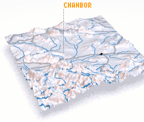 Places with similar names to Chāh Bor, Iran ::
Disclaimer :: Information on this page comes without warranty of any kind |
||
|
Where is Chāh Bor? Elevation and coordinates ::
Latitude (lat): 33°44'0"N Longitude (lon): 49°29'0"E
Elevation (approx.): 2016m (map arrows pan, magnifying glasses zoom) |
||
|
Visiting Chāh Bor? Hotel/Accommodation ::
Book a hotel in Chāh Bor Travel Guide ::
Buy a travel guide for Iran rental cars ::
car rental offers GPS waypoint ::
download a GPX waypoint (PoI) of Chāh Bor for your GPS receiver
|
||