|
search place name
|
||
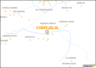
Chāh-e Jalāl (Kermān, Iran)Chāh-e Jalāl is a town in the Kermān region of Iran. An overview map of the region around Chāh-e Jalāl is displayed below.
regional and 3d topo map of Chāh-e Jalāl, Iran ::
Chāh-e Jalāl airports ::
The nearest airport is BND - Bandar Abbass Intl, located 147.7 km south west of Chāh-e Jalāl.
Other airports nearby include KHS - Khasab (248.3 km south west), Nearby towns ::
Chāh-e Āb Zīlak (0.0km north) //
Chāh-e Mīrzākhān (1.9km north) //
Chāh-e Moḩammad Ḩasan Khān (1.9km north) //
Gāv Chāh (1.9km south) //
Chāh-e Shojā‘ (1.6km east) //
Sargarīch (2.4km south) //
Chāh-e Darvīsh (2.5km south west) //
Konār Eshgī (2.5km north east) //
Chāh-e Tāj ed Dīnī (2.5km north east) //
Chāh-e Shūrī (2.5km north east) //
Sargarīch-e Bālā (3.0km north) //
Sar Gorīch (3.1km north east) //
Chāh-e Morād (3.8km south west) //
Chāh Sham‘ (3.8km north east) //
Mehrūʼīyeh (6.5km west) //
Chāh Ney (6.7km north east) //
Chāh-e Āryāmehr (7.5km north east) //
Seyyedābād-e Pā'īn (8.5km north) //
Zīārat-e Ḩaẕrat-e ‘Abbās (8.6km north west) //
[all distances 'as the bird flies' and approximate] 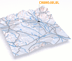 Places with similar names to Chāh-e Jalāl, Iran ::
// Chāh-e Jalāl (IR)
// Chāh-e Jalāl (IR)
Disclaimer :: Information on this page comes without warranty of any kind |
||
|
Where is Chāh-e Jalāl? Elevation and coordinates ::
Latitude (lat): 28°7'0"N Longitude (lon): 57°29'0"E
Elevation (approx.): 650m (map arrows pan, magnifying glasses zoom) |
||
|
Visiting Chāh-e Jalāl? Hotel/Accommodation ::
Book a hotel in Chāh-e Jalāl Travel Guide ::
Buy a travel guide for Iran rental cars ::
car rental offers GPS waypoint ::
download a GPX waypoint (PoI) of Chāh-e Jalāl for your GPS receiver
|
||